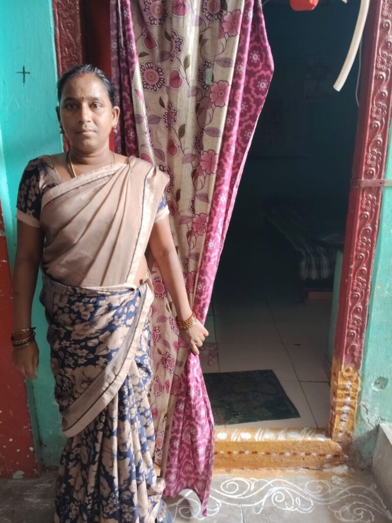
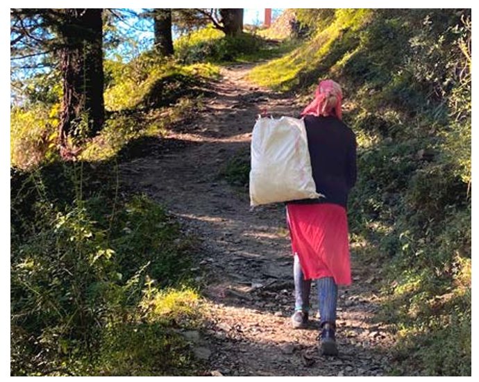
#informal settlements

Events

Consulting with the communities

Consulting with the communities “What did you have for tiffin (breakfast)?” This question brings a smile to the faces of the people sitting in for community meetings of the Urban SHADE project. In these meetings that started in February 2026 are conducted in the community, the Vijayawada-Guntur team and the Shimla team discuss the findings and the proposed intervention of the Urban SHADE project.  The meetings have been set up in people’s houses within the community which they have generously opened for the Urban SHADE team, despite houses being small and cramped. In Guntur and Vijayawada, the hosts removed the cot from the house to make space for the duration of the meeting. In Shimla too, a friendly person’s house, public spaces such as grounds, or Anganwadi centres or even the lobby of a residential building were used for these meetings.  We are grateful to everyone who helped us organise these meetings. The meetings were conducted with different groups from different sites of the settlement- women, old persons, persons with disabilities, outdoor workers and those with chronic illnesses. In Shimla, meetings were also determined by the location- such as upper part of settlement, and the lower parts, and some occupational groups such as municipal sanitation workers. In Vijayawada and Guntur, the team hung relevant photos and distributed some photos among the participants that helped spark discussion among them. There were photos of cracked walls of houses, hospitals, garbage on the road, newspaper headlines of floods, flood warning messages or illustrations depicting heart illness among others. This technique helped a great deal in communicating the findings of the qualitative research including focus group discussions and in-depth interviews, especially since many of the participants were illiterate or semi-literate. Persons who participated in these meetings discussed the garbage in their areas, what happened during the floods, or their experiences in public hospitals or private clinics. Many people who attended the meetings said that they saw the messages sent by the government on flood warnings for the first time. They spoke about how they barely got food or water during the heavy floods in 2024. The community members also suggested their ideas for possible interventions.  In Shimla, the team presented an illustrated flow chart with the findings, gaps and the planned intervention activities. The team explained that the qualitative study presented cardiovascular diseases, musculoskeletal problems, skin disease, alcohol and drug addiction as problems facing the community. There are also increased out-of-pocket expenditures due to lack of ambulances and unavailability of medicines in government hospitals. The distance of the hospitals deters people from going there, especially older persons who are unable to walk up to main road, often leading to them missing out on follow-ups. Both informal settlements in Shimla do not have functional Primary health centres. Pregnant women and children have to go to hospitals further away to get basic check-up or immunisation. People reflected on how they are unable to sleep when during heavy rains. While they do get flood messages, they have no idea what action should be taken. The team also presented a general lack of awareness about the diseases caused due to extreme rainfall, and suggested interventions. These meetings helped validate the findings and also get buy-in from the community for the intervention activities still being planned. In Andhra Pradesh the team includes researchers Pavani Pendyala and Hemanth Chandu, field coordinator Satyanarayanamma Methukulla and community co-researchers Dasari Madhavi and Maddela Siva Parvathi. In Shimla, the team includes researchers Inayat Singh Kakar, Dr Yetika Dolker, and field coordinator, Sahil Kumar. 

Musings

Nowhere to go

Nowhere to go Dr. Abu Conteh It’s 12pm on a bright beautiful Monday morning, and the sun is beginning to get ahead of me. I am visiting the Soja town section of the Moyiba community to talk to Sia, whose house was recently destroyed by a mudslide. Moyiba is one of the most deprived informal settlements in Freetown, which is also exposed to multiple hazards including mudslides. Sia is a single mother of three who makes a living from stone mining. As I ascend the over 600-meter-high hill, I couldn’t help but wonder how women in this rugged part of the community deal with climate hazards and access healthcare. In the past years, women in this section of the community have had to deliver babies by the side of the road as they couldn’t make it to the only government health clinic in time about 3 kilometers away. Transportation here is a challenge, as motor bike riders complain of rugged roads. As I arrive at Sia’s home, she greets me warmly and offers me a seat in her delipidated single bedroom mud house that was destroyed by a huge boulder (in 2025). The house is now a relic of the original two-bedroom house built by her husband who died two years ago. “The destruction of the house has changed my life so badly”, she said. She recounted her daily horrors of having to live in a leaking house or rebuilding it withher meagre income. “I can barely feed by children, let alone rebuild this house.” As I looked around, I could see that most houses here are built with mud bricks, which makesthem vulnerable to extreme weather events such as flooding and mudslide. Sia recounts she is not the only woman affected. ‘‘Last year, one woman lost two children because of a mudslide,” she said. While she feels the community is not safe, she is worried about having to leave a whole life behind that she has built for over a decade. ‘‘I have nowhere to go. We are not offered any help by the ‘’big ones.’ No one has helped me since my house got destroyed,” she said.

Musings, Uncategorized

No future

Menaka Rao Ashu waited for me outside the hotel. He is a skinny man, and was visibly uncomfortable standing in the lobby of the hotel. He insisted on meeting me in the hotel, and not in Krishna Nagar, where he lives. He says his father was a municipal waste worker. But he drank so much that the children could not go to school. Ashu dropped out of school in his 7th standard. He became a contractual waste picker after his father’s death.  “There is no future in this work, Madam,” he told me, shaking his head. He feels the futility of his job, while not being able to see a way out. “I just don’t want to go to work, especially during the monsoon. The waste which I carry on my back just gets right into my clothes and trickles down my body. There is dal, curry, all kinds of food,..,” he said, trailing off and making a face full of disgust. His school-going son asked him one day why he did waste work. “I felt very bad that day,”he said. During one monsoon, about ten years ago, his family had to leave the house, built by his grandfather, because it got dangerous. The floor of his house cracked further and further, threatening to collapse. “We kept thinking the floor would stop caving, but it kept getting worse,” he said. They now live in a rented premise, cutting into their meagre income. So when he fractured his leg this year because of an accident at work, he had to borrow nearly Rs 20,000. He was out of work for three months.  “There is no future in this work, madam,” is his only refrain.

Blog

Lessons from margins: Insights from visit to Shimla’s Krishna Nagar

Lessons from margins Insights from Urban SHADE team visit to Shimla’s Krishna Nagar Looking at the paved roads and cemented houses at the beginning of Krishna Nagar settlement in Shimla, the first reaction of Urban SHADE members from Sierra Leone and Kenya was- “This place does not look like an informal settlement.” Krishna Nagar is an informal settlement at the heart of Shimla city. The Urban SHADE consortium visited Krishna Nagar during the Annual General Body Meeting on November 30. The consortium members were first trying to size up the differences and similarities between their field sites and Krishna Nagar. The settlement was built during the colonial times to house waste workers and other labourers. People in Krishna Nagar do not have land tenure.  “The structures in Krishna Nagar looked stronger. The houses in our settlements are not as strong. In fact, even with a bit of heavy wind, the houses can be destroyed,” said Tena Kabba from Institute of Gender and Children’s Health Research (IGCHR) in Sierra Leone, which works with three informal settlements in Freetown for the project. The consortium members from Sierra Leone felt that Krishna Nagar with its steep slopes and steps resembled Moyiba a little.  But as the members walked down towards the lower part of the settlement which is right at the edge of the hill, the challenges became apparent. Though the houses look well taken care of, some of them even have a small garden in front of them, many of them have big cracks.  “My first thought was, is this really an informal settlement?,” said Michelle Koyaro from Slum Dwellers International, Kenya. “We then saw the housing conditions. The walls of many houses are full of cracks. It places them in a vulnerable state. They are not sure if they will be able to live in the house next monsoon. I realised that if someone does not know the context definition of informal settlement, they will quickly cancel Krishna Nagar as informal settlement. ” And indeed, many houses have collapsed at the edge of the hill during the 2023 landslide when the Slaughterhouse collapsed. The consortium members met a man who sent his family to his native place but continued to live in a house perched at the edge of the hill. He said he had no option because he had to make a living in Shimla.  What struck many Urban SHADE members is how much people invested in the houses. The houses are by and large cemented, and many have taken effort to even have a garden in a small strip of land. The roads in the upper part of the settlement were built by the municipal authorities. The consortium members then saw older persons trying to walk up the stairs, as well as houses with big cracks perched precariously at the extreme lower part of the settlement, at huge risk of being washed out by rains. Dr Jiban Karki, from Liverpool School of Tropical Medicine (LSTM) said that the lower parts of the settlement were revealing. “I visited Krishna Nagar twice. But this time we went further down, where we saw all the cracked houses. We found that people were still living there despite the danger. There was another vulnerable population who were living in rented houses. Towards the top of the hill in Krishna Nagar people were relatively better off, then those in the lower range.” Dr Karki spoke about meeting some Nepali origin people in the lower parts of the settlement who lived on rent, in houses that were more precarious. As the consortium members tried to climb up the stairs they realised how difficult it is. ”I kept thinking about how many elderly people live there. As young as I am, I was barely able to climb the stairs. Even if there is a car available, it is hard to get to the main road,” said Dr Desta Ali, from IGCHR. Many wondered how pregnant persons and those with disabilities climb stairs everyday.  Some of the Urban SHADE team members met an elderly lady who had great difficulty climbing a steep flight of stairs. She took breaks sitting down at the side of the stairs while walking up with a stick.She sought help from some teenagers passing by.  The consortium also saw the building of the primary health centre (PHC) which is currently non-functional. The older PHC which was there earlier collapsed more than a decade ago during the monsoon. The team from Sierra Leone and Kenya observed that they had a functional health facility within most of their settlements they are working with for the Urban SHADE project. The ASHA workers present in the meeting also raised various problems people in the community faced because of PHC.  Dr Ijeoma Onyeahialam, who works with LSTM observed, “In relation to Sustainable Development Goals (SDG), the community falls short because of the community’s lack of access to health care. The PHC is not working. After going into the community more, you can see how pregnant women are disadvantaged. This also helps various country teams to see how they can compare and see similarities.”  The consortium members also had a meeting with community leaders and ASHA workers at Valmiki temple said to have been established in the early 1900s. Valmiki is a patron saint for Dalits. The discussions ranged from lack of land tenure, caste discrimination and access to healthcare.  The community leaders of Krishna Nagar spoke about how the government keeps trying to evict them, as it falls on prime land. “Just before the elections, the political leaders promise that they will ensure we will be granted land tenure. But after elections, these promises vanish,” said Kuldeep, who is with the Valmiki Sabha  The teams from Sierra Leone and Kenya said that it’s just the same situation in their hometowns with informal settlements. Except, the people working in the settlements there refrain from investing their money in building a better house because of the fear of eviction.  “People

Musings

Battered and bent, but still standing

Battered and bent, but still standing Desta Ali Down the long, steep, steps of Susan’s Bay stands a tall, green five-storey building. It looks weathered and worn, but it stands stubbornly and quietly. During the day it is virtually empty, but I’m sure it houses more than hundred people at night. There is a lot of cracks in its concrete; its roof is made of rusted metal sheets. The building tells a story of time. Every time I look at it, I hear it say, “I have survived many floods, yet I am still standing. I am a survivor.” It almost makes me fall in love with it, because it reminds me of myself, standing tall in the midst of trials, keeping my head high, and trying very hard not to crumble. The glasses on the windows are broken, yet the bars are still holding on, almost as if fighting hard to maintain security. The top floor of the building is unpainted. That means it has been added recently to create more space for more people. The bottom floor is incomplete and wrapped with tarps and more rusted metal sheets. It was possibly built as a garage but is now being used as an accommodation for a desperate family. This tells a story of greed, because someone has decided that making money from rent is more important than the safety of people. I admire the building for all it has gone through and all that happens within its walls. But I also feel sorrow and dread. I know it’s only a matter of time before it crumbles. The land it is built on is a coastal land and not meant for buildings. I am sure its foundations were not made to carry that much weight. I always ponder how many more floods can it survive? How much more erosion can its foundations take? My only hope is that when that day arrives, it will happen during the day, when no one is home.

Blog

शिमला की बस्तियों में सर्वेक्षण करने का अनुभव

शिमला की बस्तियों में सर्वेक्षण करने का अनुभव साहिल कुमार 2021 में, मैंने अपनी ग्यारहवीं और बारहवीं लाल पानी स्कूल, कृष्णा नगर से की थी। मुझे मेरे घरवालों ने बताया था कि किसी के साथ काम से हटके बात नहीं करनी है, और किसी से लड़ाई झगड़ा नहीं करना है। घर के बड़े मानते हैं कि वहां लोग जल्दी लड़ाई झगड़े में उतर आते हैं, पर मेरे साथ स्कूल के दौरान कभी ऐसी कोई घटना नहीं हुई। सितंबर महीने में जब मैंने Urban SHADE प्रोजेक्ट में काम करना शुरू किया, तभी यही धारणा मेरे मन में थी। मेरी टीम का काम था कि घर-घर जाकर सर्वेक्षण करना। हम पूरे सात लोग ये काम पर लगे थे। इस प्रोजेक्ट में काम शुरू करने के बाद, कृष्णा नगर के लोगों और जगह के बारे में मेरी धारणा और अनुभव में आया बदलाव।  हमने Urban SHADE प्रोजेक्ट हिमाचल प्रदेश के शिमला की अनौपचारिक बस्तियों में घरेलू स्तर पर सर्वेक्षण से संबंधित आँकड़े एकत्र करना शुरू किया। हम दो बस्तियों – कृष्णा नगर और ईदगाह कॉलोनी – में काम कर रहे थे। घरेलू सर्वेक्षण का उद्‌देश्य अनौपचारिक बस्तियों में रहने वाले लोगों के स्वास्थय पर पड़ने वाले प्रभावोंऔर कमज़ोरियों को समझना है। साथ ही चरम मौसम की घटनाओं के दौरान और उसके बाद सार्वजनिक स्वास्थय सुविधाओंमें उपलब्धता को भी समझना  है।  यह मेरा पहला काम था। मेरा, शुरुआती अनुभव बिल्कुल ना के बराबर था लेकिन पहले ही दिन से नई चीजों को सिखने पर ध्यान दिया। जब पहले दिन हम अपने क्षेत्रों में पूरी टीम  के साथ गए तो हमने देखा कि कृष्णा नगर में रास्ते सीधे नही है और बहुत सी सीढ़ियाँ है। यहाँ पर लोगों के घर बहुत पास-पास है, और भारी बारिश के दौरान लोगों के घरो के जल निकासी की स्थिती बहुत खराब है। कृष्णा नगर के लोगों का कहना यही था कि बहुत से लोग आते-जाते है और सर्वे कर के चले जाते है। परंतु कोई हमारे लिए कुछ भी नहीं करता।  मैपिंग की समस्याएं हमें ट्रेनिंग के दौरान मैपिंग के बारे में बताया गया। सर्वे के पहले मैपिंग जरूरी थी ताकि कृष्णा नगर की भौगोलिक स्थिति के बारे में और घरों की स्थिति के बारे में अच्छे से पता चले।  दोनों क्षेत्र- कृष्णानगर और ईदगाह पहाड़ी क्षेत्र हैं,और रास्तों में उतार चढ़ाव बहुत है।  मेरे सीनियर्स और टीम मेंबर्स को भी कृष्णा नगर में मैपिंग के दौरान ऊपर नीचे चढ़के थकान का सामना करना पड़ा। हम सोच में पड़ गए कि यहाँ के लोग, विशेष रूप से बुज़ुर्ग लोग, कैसे रोज चलते फिरते होंगे। सर्वे के दौरान हमें बुज़ुर्ग बताते थे कि उन्हें नीचे से कार्ट रोड पहुँचने में बहुत समय  लगता है। बहुत से बुज़ुर्ग डंडा पकड़कर, बीच में बैठ-बैठ कर धीरे-धीरे ऊपर तक पहुँचते हैं। मैपिंग में मुझे कई जरूरी चीजों का ध्यान रखना पड़ता था। कोई घर छूट ना जाए। लोगो से रास्ते को पूछना या कौनसा घर किस से जुड़ा है। कृष्णानगर में पालतू और आवारा कुत्तों का डर बहुत ज्यादा था। हमें डर था कि ये आवारा कुत्ते हमें ही काट न दें। हम लोगों को पूछ कर ही गालियों में जाते थे। जिन घरों में पालतू कुत्ते होते थे वह उन्हें पकड़कर या बांधकर रखते थे। हमने सुरक्षित होकर मैपिंग का काम चालू रखा । मैपिंग में हमें एक ही गली में कई बार आना जाना पड़ता था। शुरुआत में थोड़ी थकान के साथ समय वाला काम लगता था। फिर मुझे इसकी आदत होने लगी। मैंने मैप के  चित्र का  ज्यादातर काम खुद ही किया है। मैप को पहले मोटे तौर पर बनाया और फिर उसे बड़े चार्ट में लैंडमार्क लिखकर तैयार किया।यह काम मुश्किल था क्योंकि  गलीयाँ कहीं न कहीं एक दूसरे से मिलती हैं। इस दौरान, मैं और मेरी टीम घंटों वाल्मीकि मंदिर में बैठकर काम करते थे। वहाँ का माहौल अच्छा था और लोगों को हमारे काम के बारे में जानने में दिलचस्पी थी। मुख्य घरेलू सर्वे की शुरुआत पायलटिंग के दौरान मेरी एक परिवार से बात हुई।  इन लोगों ने 2023 में स्लॉटर हाऊस के हादसे को अपनी आंखों से देखा। उन्होने अपने घर के साथ लगती नालियों और बुरी जल निकासी  (drainage) के बारे में बताया। उन्होंने बारिश के दौरान अपने घर को छोड़ने की स्थिती और अनुभव को मेरे साथ साझा किया।  एक और दुखी परिवार के अनुभव को भी मैने सुना था। उन्होनें कुछ साल पहले नया घर खरीदा था जो कि 2023 के स्लॉटर हाउस क लैंडस्लाइड (landslide)  हादसे में तबाह हो गया।आज उस परिवार को किराए के घर में अपना जीवन यापन करना पड़ रहा है। सर्वे के पहले दिनों में मेरा अनुभव ठीक रहा और लोगो से बात करके अच्छा लग रहा था। सर्वे के तीसरे दिन, जब मैं एक आदमी से सर्वे के सवाल पूछ रहा था, उन्होंने घर के संबंधित सवालों के बारे में बुरा मान लिया। उनका व्यवहार मेरे प्रति बहुत अच्छा था परंतु उनको सर्व के कुछ प्रश्नों से थोड़ी परेशानी थी। उन्होंने  सर्वे रोकने को कहा और उन्होंने मुझे डेटा टैबलेट से मिटाने को भी कहा। कुछ देर के लिए उन्होंने टैबलेट मेरे हाथ से लेकर उसमें कुछ देखने भी लगे। इसके बाद में हमारे टीम के सीनियर ने कृष्णा नगर के वाल्मीकी मंदिर वहाँ के निवासियों के साथ बैठक की । उन्होंने सर्वे के बारे में अच्छे से समझाया। इस बैठक से लोगों को समाधान मिला और सर्वे सामान्य तरीके से चल पड़ा। और उसके बाद वाल्मिकी सभा के लोगों ने हमें सर्वे के लिए और ज्याया प्रोत्साहित किया।  लोगों को दिक्कत व परेशानियाँ लोगो का मेरे प्रति व्यवहार अच्च्छा रहा। लोग जानकारी देने के लिए पूरा समय देते थे और अपने पूर्व प्रभावो को हमारे साथ साझा करते थे। लोग अपनी गंभीर बीमारियों के बारे में भी हमारे साथ जानकारी साझा करते थे। लोगों ने  बताया कि कार्ट रोड तक आने-जाने  से जोड़ों में दर्द होता है।यहाँ का नाला कूड़े से भरा रहता है, और जो लोग नाले के पास रहते हैं वे इससे ज्यादा परेशान रहते हैं। इससे वर्षा के मौसम में समस्या आती है और बीमारियाँ पैदा होती हैं। कृष्णानगर में ऐबुलेंस की सेवा भी ना के बराबर है। मौसम के कारण

Blog

How terrain of the informal settlements has impact on health

How terrain of the informal settlement has an impact on health  Almenatu Samura It is well known that living in informal settlements poses a risk to health because of lack of formal recognition, and the residents facing various socioeconomic, environmental and political exclusions. In the coastal informal settlement of Susan’s Bay, one’s access to health is also determined by what part of the settlement she lives in.  Since the settlement is built on steep, tiered landscape, people living in the lower parts of the settlement have to climb long flights of uneven stairs to get anywhere. This includes going to the only public health facility, Susan’s Bay Community Health Centre that serves the settlement, which is perched on the upper end of the informal settlement.  While this reality touches every resident, it falls heaviest on the most vulnerable groups persons with disabilities, the elderly, children, and especially pregnant women.  The terrain makes daily movement for residents, especially vulnerable ones, exhausting and sometimes impossible. “There’s no part of the community without staircases. To exit the area, you must climb, which is a major challenge for us,” one resident explained. Residents at the lower end of the settlement struggle to reach it, especially during medical emergencies, and disasters such as fire and storms. In 2021, a massive fire swept in Susan’s Bay injuring hundreds of people and destroying much of the infrastructure. The lack of roads prevented fire engines to reach the community to put out the fire. Life-threatening delays during childbirth Pregnant women find the uphill journey daunting, often missing critical antenatal appointments or experience life-threatening delays to reach the health facility during labour. The consequences are devastating from miscarriages and preventable complications to tragic maternal and newborn deaths. The community members talk about cases where pregnant women have failed to reach health centre, losing their lives.  As per the latest UN estimates, Sierra Leone has made strides in reducing the maternal mortality ratio from 1682 deaths per 100,000 live births in 2000 to 354 in 2023. But 354 deaths per 100,000 live births is still too high a number- about three maternal deaths a day. Stories of women dying of childbirth abound in the settlement.  A community leader speaks about the case of a pregnant woman who died of childbirth after she could not reach the health centre. She lived in the lower end of the informal settlement. “The pregnant woman was unable to reach the health center. She returned home and delivered with a traditional birth attendant (TBA). The mother couldn’t make it out alive,” recalled a community leader. After the complications, the woman was taken to the health facility where an emergency C- section was done.  Beyond the steep terrain, narrow and congested roads compound the crisis. Traders often line the pathways, leaving little space for movement. The environment is physically inaccessible, disaster-prone, and socially excluding. This is especially true when a fire breaks out, or during floods when it is impossible to move fast. A disabled resident said that being carried on someone’s back is “dehumanising.” No “free” healthcare There are other barriers to access to healthcare. Despite the Free Health Care Initiative (FHCI) that was launched in 2010, people talk about hidden costs, medicine shortages. Informal payments keep many away from clinics.  Many residents living in Susan’s Bay lack reliable income and the rising cost of living is deepening their hardship. This hardship is compounded for vulnerable populations who then depend on informal health care rather than the formal system.  “I don’t have a steady job, so if I can’t afford tests or drugs, I simply go without treatment,” said a man with a disability. A recent Human Rights Watch report looking at obstetric violence in Sierra Leone said that indigent women are at a higher risk of obstetric violence if they cannot make informal cash payments to staff in government facilities for services, drugs, and other commodities, even if in an obstetric emergency. The report is based on more than 130 interviews with patients, healthcare providers, government officials, and public health and policy experts in Sierra Leone  in 2024 and 2025. Community health workers say that many pregnant women too are abandoned by their partners, left to fend for themselves. Accessing formal healthcare becomes daunting for such women. In the face of these barriers, community health workers (CHWs) serve as the invisible bridge between the health system and those most at risk. They identify pregnant women who have not registered for antenatal care, provide referrals, and raise awareness on safe delivery practices. “Some women never attend ante-natal until CHWs visit them at home. Many don’t even have antenatal cards,” said a CHW. Without their outreach, maternal and newborn deaths in Susan’s Bay would likely be far higher. Susan’s Bay’s story is not an isolated one. Across Sierra Leone’s informal settlements, residents find it difficult to access healthcare. Addressing this requires more than infrastructure; it demands inclusion, empathy, and sustained attention.  To build resilience in Susan’s Bay, interventions must prioritise accessible and inclusive healthcare facilities, improved mobility pathways for persons with disabilities and the elderly, community-based maternal health programs, livelihood support for vulnerable women and people with disabilities, and stronger emergency preparedness and response systems.

Blog, India

Experiences of co-creating survey with communities facing climate health risks

Experiences of co-creating survey with communities facing climate health risks In late October 2025, the Urban SHADE project in India will start on data collection related to the household level survey in the informal settlements in Shimla in Himachal Pradesh, Vijayawada and Guntur in Andhra Pradesh. The household survey aims to understand health impacts and vulnerabilities of people living in informal settlements, as well as the extent of care available to them in public health facilities during and following extreme weather events. The Urban Shade Project, aims to strengthen  health services for people living in urban informal settlements, to respond to impacts of extreme weather events. The enumerators in both states underwent an extensive training programme in September, which covered the details about the project, ethics of data collection, mapping and use of survey software. The project has involved the community in every step of the way.  The design of the survey tool – Household Survey: Social and Health Vulnerability Assessment related to Extreme Weather Events– was led by a member of the research team, Malini Aisola with extensive inputs from research and field team members. The survey includes social demographic profiles of household members, access to utilities and infrastructure, access to health services, housing, past impact of extreme weather events, people’s perceptions, awareness and responses on extreme weather events. The survey will be conducted in informal settlements in Vijaywada-Guntur, and two informal settlements in Shimla. The two extreme weather events we are looking at in the project are extreme heat and extreme rainfall/flooding.Through the household survey, the team aims to generate context-specific data about a variety of indicators of social and health vulnerability, and provide insights about how they shape experiences of extreme weather events. For example, those living in the poor quality houses, and do informal work may feel the impact of extreme heat more.The survey would enable granular descriptions at the settlement-level of prevailing conditions that could inform government policies and local preparedness planning including provision of health services. Consulting the community on survey tool The Urban SHADE research teams had fortunately worked with some of the settlement sites in the project earlier in another project called Accountability for Informal Urban Equity (ARISE), an action research project focussing on health and wellbeing of sanitation workers. In some other communities, efforts were made to engage with the community in a meaningful way before data collection. In Eidgah colony, a public meeting was organised with support from key stakeholders including the Maulvi of the mosque, the ward councillor, community leaders, an official from National Health Mission and ASHA workers in the settlement.  Anmol Somanchi, a developmental economist and member of the research team in an advisory capacity, helped the team develop a conceptual framework for measuring vulnerabilities. After developing a basic draft with inputs from research and field team members, our team presented it to the members and stakeholders of the settlements in Vijayawada, Guntur and Shimla.  The workshops included residents, community leaders, elected officials, health workers, civil society members of these settlements we are studying in including Krishna Nagar, and Eidgah colony in Shimla, Vambay colony and New Raja Rajeswari Peta (also called RR Peta) in Vijaywada, and Sarada colony in Guntur. The one-day workshop was organised by the research team of Inayat Singh Kakar and Yetika Dolker in Shimla, and Pavani Pendyala and Hemanth Chandu in Vijayawada in May.  Apart from talking about the survey, key questions were read out and displayed in the workshop to the community members to discuss their relevance, the way they are worded, as well how the data could be relevant to the community for advocacy. Community members gave suggestions on improving the questions as options to click to elicit an appropriate answer.  Mahesh aka Shiva who lives in RR Peta gave suggestions to simplify the Telugu questions, making it closer to spoken language rather than very Sanskritised. “In the workshop, you  (Urban SHADE team) asked us whether we were able to understand the language or not, and modified the questionnaire based on the language we were able to understand,” said Mahesh.  The workshop helped the research team to overcome engagement challenges in one of the settlements in Andhra Pradesh who were unfamiliar with the research teams’ work and helped familiarise them with the research. These members helped facilitate community engagement for the researchers. Reena Chauhan, Accredited Social Health Activist or ASHA worker works with the community in Eidgah colony. ASHA workers work closely with the communities and link them up with services in the public health facilities. Asha workers used to conduct government-related surveys.  “For the first time, someone has asked us anything before conducting any kind of survey. Usually we are just asked about our targets related to our work in taking pregnant women for check ups or checking on newborns, or motivating tuberculosis patients to take their medicines,” said Reena Chauhan, ASHA worker in Shimla Taking feedback from the community is in line with participatory action research methodology which this project is committed to. It also adheres to the principle laid down in the Human Rights Approach to Data, that talks about including means for active, and meaningful participation of relevant stakeholders, especially the most marginalised population groups during the entire data collection process including planning before the survey roll outs.  Deciding boundaries of the settlement For the project and particularly for the survey, it was important to determine the boundaries of the settlement- what part of the settlement will be covered for the survey, and what will be left out. The boundaries then determine where the enumerators and researchers 1can move around and conduct the survey.  In Vijayawada and Guntur, there were some areas adjoining the informal settlements where the middle class families lived in visibly well-made houses. The project’s Vijayawada-based researcher, Hemanth Chandu sat with community persons, Madhavi, Kosamma, Mahesh and Shiva in RR Peta and Vambay Colony, Vijayawada and Akkamma and Shiva Parvati in Sarada Colony, Guntur. Of these, Madhavi and Shiva Parvati are community

Events, India

Enumerators workshop India

September 2025 Household Survey Enumerators workshop, India  The Urban SHADE project in India conducted a training of enumerators for conducting the Household Survey: Social and Health Vulnerability Assessment in September. The workshops were held first in Vijayawada and then Shimla in five-day spans between September 8, 2025, to September 22, 2025.  In both the workshops, the research team conducted a focus group discussion with the enumerators to get a pulse on their understanding and knowledge about the different informal settlements we are studying, impact of extreme weather events in such settlements among others. Many of the enumerators who had prior experience conducting surveys participated wholeheartedly on their understanding of extreme weather events, and the various challenges in conducting surveys in the field.  The research team including Hemanth Chandu, Malini Aisola, Inayat Kakar and Yetika Dolker explained to the enumerators about the Urban SHADE project and broadened their understanding of extreme weather events and how it affects people with different vulnerabilities especially the poor who live in informal settlements, disabled, or those with precarious jobs, or with chronic illnesses differently. Each section of the survey, and their questions were explained to the enumerators. The sessions covered Ethics related to data collection in great detail. It was emphasised that the data collection must be implemented consistent with the principles of the Human Rights Based-Approach to Data. The research team spoke about maintaining confidentiality and privacy of the people who will be asked questions from the questionnaire. The enumerators were made aware of the gender and cultural norms that could come to play while conducting the survey. The research team also highlighted that data collection should not lead to further discrimination among the already marginalised communities that the Urban SHADE project works with.  The interviewers were given detailed instructions on preparing for the survey, introducing themselves, obtaining consent, and taking a survey. The participants were given mock practice sessions where one of them played the respondent and other played the enumerator.  The situations included dealing with a busy mother who had no time, or a person concerned about the survey leaking information to the government. The situations which were designed to be tough helped the enumerators practice their skills in seeking consent and trying to convince people for a survey by being transparent and respectful. The role-playing activity broke the monotony of the typical workshop with presentations.  Balaji Rao Nemala gave hands-on training on how to map settlements where the survey is to be conducted. Nemala (photo below) who is the Project Manager with The George Institute, has handled trials all over India in both urban and rural settlements. Mapping literally means drawing a map of the settlement on paper. Nemala guided the enumerators in the field on how to map the structures in a way that they do not miss a single house. This exercise gets complicated in informal settlements, which barely have any straight paths. In Shimla this was compounded by the fact that the settlements are on hilltops which required a lot of physical labour of climbing up and down the hilltops. The enumerators covered the length and breadth of the settlements marking structures in each of the narrow lanes of the settlements. The people in the settlements who were curious about the exercise asked them about it, giving the enumerators a chance to explain the survey to them.  Bijini Bahuleyan, Data Manager withThe George Institute made the data base for the survey which is to be conducted in Telegu and Hindi. She also helped participants log on RedCap software which will be used for data collection in the survey, and trained them on how to use the software for data collection.  The survey is expected to begin in October. In Vijayawada and Guntur informal settlements (Vambay Colony, RR Peta and Sarada Colony), the survey will be conducted in Telegu. In the Shimla informal settlements (Krishna Nagar and Eidgah colony), the survey will be conducted in Hindi.

Blog, Sierra Leone

When Communities Map Themselves, Policymakers Start to Listen

When Communities Map Themselves, Policymakers Start to Listen Geographic Information System (GIS) is a computer system for capturing, storing, analysing and displaying data that are spatially referenced to the earth. GIS is used to create maps, analyse patterns and identity relationships. GIS is increasingly used as a tool to help map informal settlements with respect to utilities, waste management, roads, infrastructure, among others. Richard Bockerie is a seasoned data and software development professional with over a decade of experience in advanced data collection, management, analysis, and mapping, specializing in community-driven research and climate resilience projects. Holding a degree in Computer Science, he has effectively led mapping and training initiatives across multiple African countries. As Programme and Technical Manager at the Centre of Dialogue on Human Settlement and Poverty Alleviation (CODOHSAPA), the Sierra Leone affiliate of Slum Dwellers International (SDI), Richard leverages cutting-edge data platforms and GIS technology to provide actionable insights that underpin climate adaptation strategies and sustainable development policies. His work centers on delivering reliable, high-quality data critical for research on climate change impacts, urban planning, and community resilience. With expertise in monitoring and evaluation, system development, and business analytics, Richard empowers stakeholders to make evidence-based decisions that enhance environmental sustainability and socio-economic well-being in vulnerable populations. Through his role, Richard contributes to global efforts addressing climate change challenges by bridging technological innovation with grassroots knowledge, strengthening capacities for informed climate action in the most affected regions. Richard spoke to Menaka Rao, Urban SHADE’s Project Communication Officer. These are the excerpts of the interview. Menaka: How did you first start using GIS mapping in informal settlements? Richard: We began using GIS in 2015. At that time, I was responsible for analysing data of  a household survey. While quantitative data provided valuable insights, I realised it did not capture the full reality on the ground. We needed a way to represent the data spatially for a clearer picture. “Unlike traditional reports filled with graphs and tables, a map resonates with people because they can see and identify their own neighborhoods, homes, and places of work. This connection empowers them to participate actively in planning and decision-making.“ For example, if I say 50% of households lack access to water points, that’s useful. But it’s even more actionable when I can pinpoint which specific zones those households are in. Mapping the data allows us to identify areas with high and low access to services. Another instance is when community members report exposure to flooding, landslides, and other hazards—GIS lets us locate exactly where these risks exist. It became clear that quantitative and qualitative data alone couldn’t tell the entire story. GIS tools became essential in supporting our evidence and enabling evidence-based decision-making. Maps make the data more relatable and understandable for communities. Unlike traditional reports filled with graphs and tables, a map resonates with people because they can see and identify their own neighborhoods, homes, and places of work. This connection empowers them to participate actively in planning and decision-making. Menaka: What can GIS mapping do to help us understand informal settlements? Richard: GIS has huge potential to help us understand informal settlements because these places exist in physical space. When we talk about land rights, access to services, or building infrastructure, we need to show exactly what is in that space—who owns what land, the size of the community, the number of buildings, and common risks like flooding or landslides. For example, if we want to help communities get land ownership, we need to clearly map the area so people can have official documents and title deeds for their land. That’s where GIS helps. GIS mapping also lets us see who has access to services and who doesn’t. I worked on a project in Freetown with the University of Chicago where we mapped the whole city’s access to essential services using the K block analysis. We found that areas closer to roads had better service than those without road access. This data helped city officials realise the problem. Because of this, the city started a project to build roads in Kroobay, a settlement in Freetown, which has made it easier to bring services to people there. So, GIS gives us clear evidence of challenges and opportunities, and when we show this to city leaders and government, they are more likely to take action. Menaka: You conduct GIS exercises with community researchers.  Can you help us understand with examples how GIS helps community members understand their own locality better? What insights do they get when they do this exercise? Richard: In participatory GIS, community members create maps of their settlement themselves, instead of outsiders doing the mapping for them. This process helps them understand their community deeply. For example, we take drone images, print them, and bring them to the community. We first explain the images and then ask them to mark important places on the map. They mark where they live, work, and parts of the settlement prone to hazards like flooding. In one exercise, we asked them to show where they dispose of waste and then identify flooding areas. They clearly saw the link between waste disposal and flooding. This helps them realize how daily actions affect everyone in the community. Menaka: Can you also give me an example about how the understanding about a particular settlement has changed after the use of GIS and how it can help identify issues that can be worked on by policy makers and other stakeholders.  Richard: And I’ll give you an example of one of Moyiba in Freetown, where the Urban SHADE project is working. When we started doing the GIS mapping, we understood that whenever it rains, the access to the committee is completely cut off because of the road network. You can’t access health facilities or any emergency services. Moyiba is a hillside settlement. We were able to draw the conclusion that the rain comes from top and slopes downwards. We could tell the community that we need to pave

Scroll to Top