Heat stress worsens chronic health conditions, residents of informal settlements hit hardest
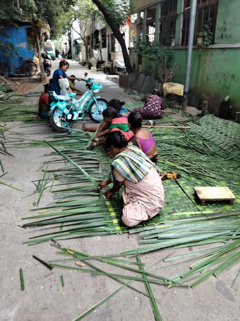
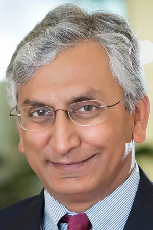
Heat stress worsens chronic health conditions, residents of informal settlements hit hardest Climate change is increasing the frequency, intensity and duration of heat extremes worldwide. In India, the average maximum temperature increased by ~0.5°C by 2000, and by ~1.0°C by 2020, as per a study published recently. Heat extremes put more individuals, communities and health systems at risk of illness, and death. People with pre-existing chronic illnesses such as diabetes, hypertension, renal disease among others are more vulnerable to heat-related illnesses. Extreme heat is known to exacerbate health risks of those living with chronic diseases and can trigger hospital visits and mortality risk as the body struggles to regulate itself under heat stress. Urban SHADE’s Hemanth Chandu and Pavani Pendyala recently wrote an article about informal settlements residents who live with chronic diseases. Urban SHADE’s Menaka Rao spoke to Dr Vivekanada Jha, executive director at The George Institute for Global Health, India, and a nephrologist and public health researcher. He is Professor, Faculty of Medicine, Imperial College London, and the past President of the International Society of Nephrology. A prolific writer and editor, Dr Jha has worked with many global organisations including the World Health Organisation to develop clinical practice guidelines and advocacy papers. His research interests include understanding the health and societal impact of kidney diseases around the world and the development of affordable, scalable and sustainable primary and secondary prevention tools. Here are the excerpts of the interview: Menaka: How does extreme heat affect persons with chronic diseases such as hypertension, diabetes? In your clinical experience, what changes have you seen among those living with chronic health conditions , especially among poor patients and those living in informal settlements? Dr Jha: Heat affects both basic biology and the response of the body to external stimuli for people with chronic diseases including hypertension, diabetes, cardiovascular disease, kidney disease, etc. As temperatures go up, we sweat more. While the sweating is perceptible when humidity is high, it is not perceptible when the heat is dry. Sweating leads to a loss of water and salt from the body, reducing the total water and salt concentration. This can lead to a reduction in blood pressure. We have seen in clinics that people with well-controlled hypertension suddenly experience low blood pressure during extreme heat. They become giddy and weak. So during the summer months, we have to reduce the number of blood pressure medicines then, especially diuretics, which have the property of increasing urine flow, further worsening fluid and salt loss. We also have to warn our patients to check their blood pressure more frequently and pay attention to how they are feeling. Many people with diabetes require insulin, which is taken in the subcutaneous region. During the heat, the body does not absorb insulin well from that site, leading to uncontrolled blood sugar levels, even if it had been previously controlled. The build up of sugar concentration in the blood leads to spillage in the urine, which draws more water with it, causing dehydration. We ask patients to avoid injecting on the limbs before physical activity in heat. The abdomen is more predictable. They should also monitor blood sugars more frequently during heat waves, especially after meals. Insulin is a protein that denatures in hot weather. It should therefore be stored in a fridge. Many in informal settlements don’t have access to a fridge. Practical solutions include using insulated pouches with ice bags or clay pot coolers. The effects of heat on kidney function have been extensively studied. When people lose salt and water through sweat, the blood flow to the kidneys decreases, and the kidneys lose some function. Let’s say a manual worker works in extreme heat from morning to evening. By evening, their kidney function becomes lower than normal. The kidney function may recover after the worker returns home and has water for the day, but repeated insults to the organ can result in long-term irreversible injury, which can progress to kidney failure. This has been well documented in many geographies around the world, including rural agricultural communities, outdoor workers such as construction workers, people who work in salt pans, and others. A population that is overlooked is women in informal settlements who have to cook indoors using coal or wood-fired stoves and therefore are exposed to high heat for prolonged periods. The body’s homeostatic mechanisms, which help us adapt to changes in our external environment, such as high heat, are impaired in those with chronic diseases like hypertension and diabetes. A younger person without any of these diseases, for example, will respond much more resiliently to heat stress. Menaka: What is the kind of advice for people with chronic diseases? Dr Jha: We warn our patients with hypertension that their blood pressure may go down during summer and that they should be mindful of any new symptoms that they develop. For example, if they start feeling giddiness or weakness, they should either check their blood pressure wherever they are or come to the clinic, where it can be checked. In that situation, we may need to reduce the number of blood pressure medications. Similarly, when the summer season ends, their need for blood pressure drugs may increase again. People with diabetes who are taking insulin, we have to advise them to keep their insulin in a cold environment, in a fridge, etc. We also tell them that when they are taking insulin, they should make sure they don’t inject it into the same site of the skin every day, especially over the limbs before physical activity. Finally they need to increase the frequency of blood sugar monitoring especially after meals. For people with kidney disease, we tell them to drink extra water and take salt when they step out. Not just one single one-litre bottle, as it’s not sufficient. We also ask them to try to avoid going out during the peak summer hours, so they go out early in the morning. For example, we tell farmers to try to