Author name: ikakar@georgeinstitute.org.in

Uncategorized

Kilifi

Dhows in Kilifi creek. By Michelle Mergler, Wikipedia commons Kilifi is a coastal town, close to Mombasa. The town lies on Kilifi creek and sits on the estuary of Goshi river also known as Voi River. Half the population in this town are estimated to live in informal settlements.  Kilifi had a huge cashewnut  production as well as processing factory which shut down because of various reasons in the 1990s. Much of the migration to the city happened because of the cashewnut industry, which is getting revived slowly now. The informal settlements cater to many who migrated here for work. The Pwani university, which was established in 2007, also provides jobs for people here. Some others who live in informal settlements have small informal businesses or engage in small trade activities. Urban SHADE is working in the informal settlement of Mibuyu Saba. Mibuyu Saba Mibuyu Saba is located in Kilifi township and is close to the Indian Ocean. The settlement is a result of the earlier roaring cashew industry. Most people here have been settled here for decades, even though they do not have a title deed. The land belongs to Kilifi town council. Some houses here are still thatched, while some have iron sheets for roofs. There are some multi-family Swahili style houses with a compound and multiple houses. The houses though are structurally stronger than the ones in Mombasa’s informal settlements because of the use of stone, which is locally available, to build walls. The settlement is vulnerable to flooding, strong winds, and high temperature. There are threats of eviction, but a process of formalisation is underway. Because of its proximity to the university, there is growing interest by private developers to develop this land. The residents have been engaging in efforts to formalize their ownership since 1986 when they formed the Mibuyu Saba Squatter Formalisation Scheme. This scheme was approved in 2007 when some lanes were approved for building houses. However, the process has been stalled for various reasons at the moment. While toilets are relatively accessible, the settlement has no proper sewer system, and therefore there is no pathway for the water to drain, resulting in flooding during rains. Water supply and electricity is adequate, but subject to contamination due to poor drainage. A waterpoint in Mibuyu Saba around poor drainage.

Sierra Leone, Uncategorized

Freetown

Freetown is the capital of Sierra Leone and a major port city. During the country’s civil war between 1991 to 2002, about 500,000 farming families were displaced in the country, many of them moving to Freetown, and continued to remain there. The migration accelerated urbanisation compounding infrastructure issues, forcing people to build informal settlements and communities. Much of this urbanisation is unplanned. The road network in the city covers just 5% of the city’s land compared to the recommended 30%. This increases climate-risk vulnerability for an already vulnerable population, especially those living in informal settlements or working in the informal sector. In 2017, flooding and mudslides in Freetown killed more than 500 people.  The Urban SHADE project will be working in Susan’s Bay, CKG and Moyiba. Susan’s Bay Susan’s Bay is a coastal settlement in the center of Freetown, which reflects a long history of British colonial rule in Sierra Leone. The settlement is believed to have been named after the wife of one of the British colonial governors in the early twentieth century. Susan’s Bay is a valuable harbour in the city that facilitates interior trade between Freetown residents and traders from coastal towns and villages in the north of Sierra Leone. The community continues to provide an important route for sea transportation of food items, including fruits and vegetables, fish, and firewood from across the Sierra Leone River into Freetown. Most residents, particularly women, are engaged in informal trade, which includes the sale of fish, charcoal, and other food items. Susan’s Bay is a valuable harbour in the city that facilitates interior trade between Freetown residents and traders from coastal towns and villages in the north of Sierra Leone. The community continues to provide an important route for sea transportation of food items, including fruits and vegetables, fish, and firewood from across the Sierra Leone River into Freetown. Most residents, particularly women, are engaged in informal trade, which includes the sale of fish, charcoal, and other food items. Susan’s Bay’s face changed after widespread internal migration during the war. There was rapid informal land reclamation, with houses built on ocean’s banks exposing residents to increased risks of flooding. The settlement is also at a risk of heatwaves and fire incidents.  Many houses are largely makeshift with corrugated iron sheet walls, lack good foundations, and are highly clustered, making them vulnerable to damage from yearly flooding and fire incidents. There are no access roads for vehicular entry, which impacts effective service delivery during emergencies, such as fire incidents. The lack of formal land deeds and building permits discourages housing improvement, with the fear of eviction. There is one community health centre delivering primary healthcare services. The overwhelming population and bad experiences with formal health service provision, such as long wait times, high cost, trust issues, and perceived poor quality of care, often make many residents turn to traditional healers or pepe doctors (informal drug sellers) before seeking formal care.  Common health conditions include malaria, typhoid, and cold, resulting from poor water sanitation conditions and proximity to the coastline.  CKG CKG is in the west of Freetown. It is an abbreviation used to describe a network of small coastal settlements built on the banks of the Congo river known as Crab town, Kolle town and Gray Bush. They are considered one community because of their proximity and similar social and environmental characteristics. It lies close to Kingtom dumpsite, one of the two largest dumpsites in Freetown. The settlement is believed to have started in the early 1970s when the National Stadium was constructed. The nearby vacant land became populated with people working on the construction of the stadium and those seeking livelihood opportunities. As migration to Gray Bush continued into the 1980s, people began to settle in the adjacent low-lying section of CKG called Crab Town, hunting crabs in the crocodile river. The coastal area near the Kingtom landfill was also reclaimed to form the other section of the community known as Kolleh Town.  After the civil war, an ensuing migration into Freetown increased overcrowding and congestion in the area. The presence of informal housing structures in waterlogged areas near the Kingtom landfill influences the recurrence of regular flooding and fire hazards, and increased air pollution.  The majority of the structures in Crab Town and Kolleh Town are made of corrugated iron sheets, while Gray Bush, sitting on top of Crab Town, largely comprises mud and cement brick structures. Livelihood activities of residents include fishing, small-scale businesses, and scavenging from the Kingtom dumpsite. Like many informal settlements in Freetown, the residents of CKG have limited public provision of good drinking water. Most of the sources are dug wells used for domestic purposes, but are unfit for drinking due to contamination, especially in the rainy season when the community floods. The other risks are heatwaves, and falling rocks and boulders. Limited pipe-borne water connected to the municipal grid is the main source of potable water, although it is also reported to be exposed to contamination in the event of flooding. The community also faces dire sanitation challenges. Residents at Crab town and Kolleh town, along the Congo River connect sewage pipes that empty sludge into the river. The lack of good drainage, poor waste management, and the existence of the Kingtom landfill at Kolleh town further exacerbate exposure of residents to health risks.  Moyiba Moyiba is a hillside informal settlement in the east of Freetown, about 5 km from the Central Business District. Established as a farming community in 1929, it was transformed into a quarry in 1966 to support major city infrastructure projects in Freetown, including roads, bridges, the national port and stadium. During the war, the settlement attracted many internally displaced persons and urban residents facing housing difficulties. The area is made of hills and has high levels of deforestation because of house construction and stone mining. (HISTORY) Housing The houses in Moyiba primarily are built with mud-brick walls and corrugated iron sheets, with a few makeshift structures,

Uncategorized

Mombasa

Mombasa Mombasa is one of the oldest cities in Kenya, second only after Nairobi. It is the largest port in East Africa, and also a major tourist destination. Mombasa attracts a lot of workers from different parts of Kenya and other countries in the region, influencing the growth of informal settlements. In Mombasa, about 40 percent of the population lives in slums that occupy only 5 percent of the total land area. Urban SHADE project will work at Tudor Moroto and Matopeni settlements in Mombasa Tudor Moroto Tudor Moroto (‘moroto’ means ‘slum’ in Kiswahili), is located in Island District, a key tourism spot. It is an informal settlement and located on government land. It is said that the area was forested and people made illicit brew and hid it there. Over time, those people staked claim to the land, and started living there and even constructed houses that were rented out. However, no one has a title deed in Tudor Moroto. People who settled here first call themselves “owners”, just  by virtue of settling on this land first. The Kenyan government sent bulldozers in 2002 to destroy the houses. Tudor Moroto, where an estimated 11,000 people live, comprises of seven clusters: Paradise, Simitini, KaaChonjo, Bandarini, Kwa Makaa, Maguniani and Mburukenge. The people in the settlement work in informal labour in the tourism industry, as casual labourers, vendors, fisherfolks among others.  When the area was first settled, houses had thatched roofs. Over time this transitioned to mud housing and structures are mainly built of iron sheets that are not durable. The area is subject to strong winds, flooding and higher temperatures during summer.  The settlement got more and more populated over the decades, with houses being built closer and closer to the sea. The people who live closer to the sea are more vulnerable than others, some even using cement bags filled with sand as the foundation of houses, or reinforcement to protect the houses from high tides. Since the year 2002, residents have continued to face eviction threats from the County government of Mombasa and “land owners”. The communities hesitate to permanently upgrade and build upon the land in fear of being evicted by landowners. They have been advocating for their secure land rights. People use boreholes to source drinking water as well as piped water.  There are barely any sanitation facilities, and the majority of people have a sewage pipe directly into the ocean. There is one public toilet provided by the government. Most of the toilets big and small are provided by so-called owners of the houses in the informal settlements, and are a paid service. But the sewer systems are rudimentary. Some of these toilets have pipes throwing sewage in the ocean, while some have just pits that have to be manually cleaned. Most toilets are communally shared among at least five to ten families. The informal settlement has six private clinics providing healthcare services. It does not have any referral hospital (tertiary level) in close proximity. Residents report paying between Ksh. 1,000 (7.75 USD) to 1,500 (11.63 USD) for healthcare services- a significant financial burden given their economic circumstances. There’s several public health facilities around the informal settlements but they are all 30 minutes to 1 hour away. Matopeni “Matopeni” means “muddy areas”. The informal settlement is located near the Kongowea market, perhaps the  biggest market within Mombasa Island. Many people who live here work in the market, or in the city. The settlement sits on government land (about 5 acres) managed by the Municipal Council of Mombasa with private players staking claim to the land. Private landowners swooped in on the opportunity of building an informal settlement near the market. Nobody here has a land deed, but about half the people who live here call themselves “owners” while half are renting houses. The residents here too are at high risk of eviction and are involved in contestation over the land from the government as well as the private developers who call themselves “owners”. The settlement is vulnerable to strong winds, droughts, heatwaves, and high temperatures. The poor drainage, and muddy area ensures that the area turns into sludge when it rains, cutting off access to clinics, schools and other critical services during the rains.  Many houses are built in multi-family Swahili style with a compound and multiple houses. They have iron sheets for roofs. Residents use boreholes and water kiosks for drinking water. Water kiosks are run by private individuals who provide water for cash. There are a few toilets that are built by the government, but a majority of people here use pit latrines that are not connected to any sewer system. Usually there is a toilet in one multi-family house. There are two dispensaries in the settlement, but most people initially seek healthcare at informal providers. People complain that the dispensary is ill-equipped, and often shuts down because it gets flooded during the rains.  Healthcare costs range from Ksh. 100-300, (0.78- 2.33usd). Essential services like vaccinations and ambulance services are unavailable. Because of the poor level of sanitation here diseases such as malaria, cholera, tuberculosis, diarrhea and eye infections are very common.

Uncategorized

Vijayawada

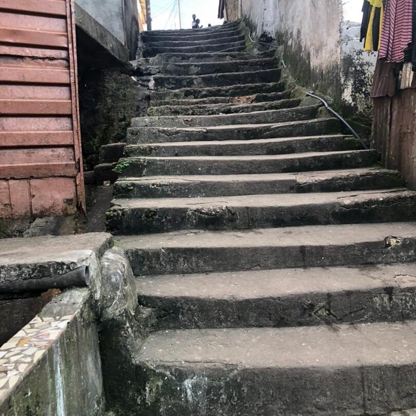
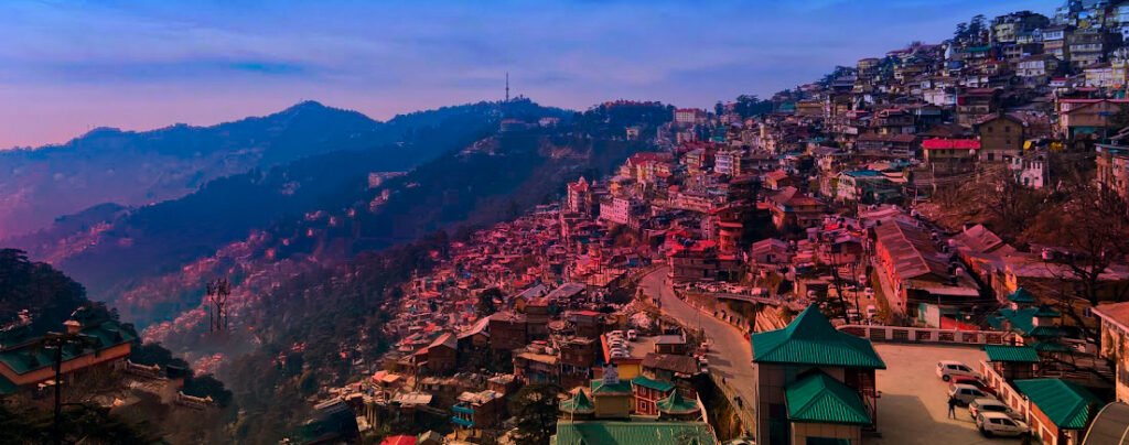
Vijayawada Vijayawada is a city in the southern state of Andhra Pradesh. It is also known as Bezawada, and was developed into a municipality in 1888. It is the second most populous district in Andhra Pradesh state. The city is fast growing, and attracts working class labourers. In Vijayawada, the Urban SHADE project will be working in the informal settlements of New Raja Rajeshwari Peta, and Vambay colony.  Vambay Colony Vambay Colony is a low-income resettlement neighborhood in Vijayawada for those displaced from informal settlements along riverbanks, canals and flood prone areas of the city. It was established in the early 2000s under the Valmiki Ambedkar Awas Yojana (VAMBAY) and later linked with Jawaharlal Nehru National Urban Renewal Mission (JNNURM) housing schemes. The colony has grown beyond the government-built buildings and has informally built houses built around these buildings.  Despite resettlement efforts, the houses have structural vulnerabilities. More than 1200 households who live here have socio-economic challenges. Residents experience recurring difficulties in accessing clean water, sanitation, healthcare, and protection from extreme weather events. The engagement of the Urban SHADE team with Vambay colony started with the ARISE (Accountability and Responsiveness in Informal Settlements for Equity) Project, which focused on vector-borne disease monitoring and health interventions among waste-picking communities.  The residents of this colony are from vulnerable lowered caste/Dalit, tribe and minority groups. Many households have second- or third-generation migrants from Andhra Pradesh’s Guntur, Krishna, and Prakasam districts who came in search of work in the city. Men mostly work as daily wage laborers, construction workers, carpenters, auto-rickshaw drivers, or sanitation workers, while women engage in domestic work, ragpicking, or tailoring. Children sometimes assist in waste collection or vending. Household incomes range from ₹5,000 to ₹10,000 per month, often fluctuating seasonally during summer and monsoon periods. Their income is seasonal and sensitive to environmental shocks, limiting economic security and social mobility. Limited access to formal banking and credit increases dependence on Self-Help Groups (SHGs) and local moneylenders, often at high interest rates which increases debt, heightening residents’ vulnerability to floods, heatwaves, and public health crises like COVID-19. The government-provided housing are three storied apartment blocks. The blocks are showing signs of deterioration. Many people have modified their homes by using tin or asbestos sheets, or cement work. Some have even created upper floors or small extensions.  Tenure is a major concern. Although residents were relocated nearly two  decades ago, they still lack formal title deeds (house registrations/house pattas). In February 2024, the residents protested for proper registrations of their houses, some even going on hunger strike. Without legal ownership, many feel they cannot claim full rights over their homes or land, feel insecure about eviction, and cannot easily access credit or make improvements. The houses are not very well maintained. Residents report damp walls, cracked pipelines, leaking roofs, especially during rains. The pipelines that supply drinking water also have leakages, complain residents. The community is exposed to extreme heat during the summer. The Vambay colony houses trap heat and cause indoor heat stress. The elderly, children, and outdoor workers are particularly vulnerable and report dizziness, fatigue and dehydration during the summer. Very few households have fans or coolers, and frequent power cuts worsen the situation.  The colony is located at the western periphery of the city, adjacent to the Budameru rivulet floodplain. This rivulet has acquired the title “Sorrow of Vijayawada” because of its propensity to flood the city. The proximity to Badameru increases the risk of floods whenever intense rainfall or upstream inflows push Badameru beyond capacity. While post-flood drainage improvements have begun under “Operation Budameru,” internal drainage within the colony remains insufficient. In 2024, more than 30 persons died in a major flood in NTR district where Vijayawada is located. The flood covered more than 40 percent of the city including Vambay colony. During these floods, homes were submerged, families displaced to relief camps, and livelihoods disrupted. There were outbreaks of water borne and vector borne diseases after the floods. The residents say that emergency responses by disaster-relief teams were delayed and that they relied on their own informal networks to evacuate. While there is a city-wide disaster management plan, Vambay colony needs a local ward disaster management committee, community level evacuation plans, or first responder training for residents. The residents are rarely included in any municipal planning initiatives. Water and Sanitation The water supply is irregular. Piped networks, borewells, and standposts managed by the municipal authorities deliver water once every 2–3 days. Households store water in drums and buckets. Sanitation is inadequate. Open drains overflow during rainfall, mixing sewage with stormwater, which facilitates the spread of vector-borne and waterborne diseases such as dengue, chikungunya, and diarrhoea. Community toilets exist but are poorly maintained, and women report safety concerns after dark. Garbage collection is irregular, with accumulated waste often blocking drains, worsening floods.  Infrastructure The internal roads and inner lanes are mostly narrow, unpaved, or partially paved. Informal extensions of structures have reduced the width of the roads here. During the monsoons, these roads become waterlogged, muddy, and slippery making it difficult to navigate especially for the elderly people and children. The narrow roads affect people’s ability to reach work, schools, or health facilities. Because of narrow lanes and encroachments, ambulance or emergency vehicle entry is constrained, particularly in inner stretches. Public transport connectivity is limited which forces residents to primarily depend on share-autos, two-wheelers, and bicycles for commuting. The combination of irregular transport services and poor road conditions adds time, cost, and risk to everyday travel, particularly for low-income households relying on hourly wages. Health and Access to Services While the nearest Urban Primary Health Centre (UPHC) is inside the community, residents complain about unavailability of staff and delay in care. The residents say they rely more on private formal and informal clinics, pharmacies. The residents are vulnerable to waterborne diseases, such as diarrhoea or cholera, vector-borne diseases such as dengue or malaria, respiratory illnesses (possibly due to pollution near garbage sites), heat related stress and ailments,

Blog

How terrain of the informal settlements has impact on health

How terrain of the informal settlement has an impact on health  Almenatu Samura It is well known that living in informal settlements poses a risk to health because of lack of formal recognition, and the residents facing various socioeconomic, environmental and political exclusions. In the coastal informal settlement of Susan’s Bay, one’s access to health is also determined by what part of the settlement she lives in.  Since the settlement is built on steep, tiered landscape, people living in the lower parts of the settlement have to climb long flights of uneven stairs to get anywhere. This includes going to the only public health facility, Susan’s Bay Community Health Centre that serves the settlement, which is perched on the upper end of the informal settlement.  While this reality touches every resident, it falls heaviest on the most vulnerable groups persons with disabilities, the elderly, children, and especially pregnant women.  The terrain makes daily movement for residents, especially vulnerable ones, exhausting and sometimes impossible. “There’s no part of the community without staircases. To exit the area, you must climb, which is a major challenge for us,” one resident explained. Residents at the lower end of the settlement struggle to reach it, especially during medical emergencies, and disasters such as fire and storms. In 2021, a massive fire swept in Susan’s Bay injuring hundreds of people and destroying much of the infrastructure. The lack of roads prevented fire engines to reach the community to put out the fire. Life-threatening delays during childbirth Pregnant women find the uphill journey daunting, often missing critical antenatal appointments or experience life-threatening delays to reach the health facility during labour. The consequences are devastating from miscarriages and preventable complications to tragic maternal and newborn deaths. The community members talk about cases where pregnant women have failed to reach health centre, losing their lives.  As per the latest UN estimates, Sierra Leone has made strides in reducing the maternal mortality ratio from 1682 deaths per 100,000 live births in 2000 to 354 in 2023. But 354 deaths per 100,000 live births is still too high a number- about three maternal deaths a day. Stories of women dying of childbirth abound in the settlement.  A community leader speaks about the case of a pregnant woman who died of childbirth after she could not reach the health centre. She lived in the lower end of the informal settlement. “The pregnant woman was unable to reach the health center. She returned home and delivered with a traditional birth attendant (TBA). The mother couldn’t make it out alive,” recalled a community leader. After the complications, the woman was taken to the health facility where an emergency C- section was done.  Beyond the steep terrain, narrow and congested roads compound the crisis. Traders often line the pathways, leaving little space for movement. The environment is physically inaccessible, disaster-prone, and socially excluding. This is especially true when a fire breaks out, or during floods when it is impossible to move fast. A disabled resident said that being carried on someone’s back is “dehumanising.” No “free” healthcare There are other barriers to access to healthcare. Despite the Free Health Care Initiative (FHCI) that was launched in 2010, people talk about hidden costs, medicine shortages. Informal payments keep many away from clinics.  Many residents living in Susan’s Bay lack reliable income and the rising cost of living is deepening their hardship. This hardship is compounded for vulnerable populations who then depend on informal health care rather than the formal system.  “I don’t have a steady job, so if I can’t afford tests or drugs, I simply go without treatment,” said a man with a disability. A recent Human Rights Watch report looking at obstetric violence in Sierra Leone said that indigent women are at a higher risk of obstetric violence if they cannot make informal cash payments to staff in government facilities for services, drugs, and other commodities, even if in an obstetric emergency. The report is based on more than 130 interviews with patients, healthcare providers, government officials, and public health and policy experts in Sierra Leone  in 2024 and 2025. Community health workers say that many pregnant women too are abandoned by their partners, left to fend for themselves. Accessing formal healthcare becomes daunting for such women. In the face of these barriers, community health workers (CHWs) serve as the invisible bridge between the health system and those most at risk. They identify pregnant women who have not registered for antenatal care, provide referrals, and raise awareness on safe delivery practices. “Some women never attend ante-natal until CHWs visit them at home. Many don’t even have antenatal cards,” said a CHW. Without their outreach, maternal and newborn deaths in Susan’s Bay would likely be far higher. Susan’s Bay’s story is not an isolated one. Across Sierra Leone’s informal settlements, residents find it difficult to access healthcare. Addressing this requires more than infrastructure; it demands inclusion, empathy, and sustained attention.  To build resilience in Susan’s Bay, interventions must prioritise accessible and inclusive healthcare facilities, improved mobility pathways for persons with disabilities and the elderly, community-based maternal health programs, livelihood support for vulnerable women and people with disabilities, and stronger emergency preparedness and response systems.

Blog, India

Experiences of co-creating survey with communities facing climate health risks

Experiences of co-creating survey with communities facing climate health risks In late October 2025, the Urban SHADE project in India will start on data collection related to the household level survey in the informal settlements in Shimla in Himachal Pradesh, Vijayawada and Guntur in Andhra Pradesh. The household survey aims to understand health impacts and vulnerabilities of people living in informal settlements, as well as the extent of care available to them in public health facilities during and following extreme weather events. The Urban Shade Project, aims to strengthen  health services for people living in urban informal settlements, to respond to impacts of extreme weather events. The enumerators in both states underwent an extensive training programme in September, which covered the details about the project, ethics of data collection, mapping and use of survey software. The project has involved the community in every step of the way.  The design of the survey tool – Household Survey: Social and Health Vulnerability Assessment related to Extreme Weather Events– was led by a member of the research team, Malini Aisola with extensive inputs from research and field team members. The survey includes social demographic profiles of household members, access to utilities and infrastructure, access to health services, housing, past impact of extreme weather events, people’s perceptions, awareness and responses on extreme weather events. The survey will be conducted in informal settlements in Vijaywada-Guntur, and two informal settlements in Shimla. The two extreme weather events we are looking at in the project are extreme heat and extreme rainfall/flooding.Through the household survey, the team aims to generate context-specific data about a variety of indicators of social and health vulnerability, and provide insights about how they shape experiences of extreme weather events. For example, those living in the poor quality houses, and do informal work may feel the impact of extreme heat more.The survey would enable granular descriptions at the settlement-level of prevailing conditions that could inform government policies and local preparedness planning including provision of health services. Consulting the community on survey tool The Urban SHADE research teams had fortunately worked with some of the settlement sites in the project earlier in another project called Accountability for Informal Urban Equity (ARISE), an action research project focussing on health and wellbeing of sanitation workers. In some other communities, efforts were made to engage with the community in a meaningful way before data collection. In Eidgah colony, a public meeting was organised with support from key stakeholders including the Maulvi of the mosque, the ward councillor, community leaders, an official from National Health Mission and ASHA workers in the settlement.  Anmol Somanchi, a developmental economist and member of the research team in an advisory capacity, helped the team develop a conceptual framework for measuring vulnerabilities. After developing a basic draft with inputs from research and field team members, our team presented it to the members and stakeholders of the settlements in Vijayawada, Guntur and Shimla.  The workshops included residents, community leaders, elected officials, health workers, civil society members of these settlements we are studying in including Krishna Nagar, and Eidgah colony in Shimla, Vambay colony and New Raja Rajeswari Peta (also called RR Peta) in Vijaywada, and Sarada colony in Guntur. The one-day workshop was organised by the research team of Inayat Singh Kakar and Yetika Dolker in Shimla, and Pavani Pendyala and Hemanth Chandu in Vijayawada in May.  Apart from talking about the survey, key questions were read out and displayed in the workshop to the community members to discuss their relevance, the way they are worded, as well how the data could be relevant to the community for advocacy. Community members gave suggestions on improving the questions as options to click to elicit an appropriate answer.  Mahesh aka Shiva who lives in RR Peta gave suggestions to simplify the Telugu questions, making it closer to spoken language rather than very Sanskritised. “In the workshop, you  (Urban SHADE team) asked us whether we were able to understand the language or not, and modified the questionnaire based on the language we were able to understand,” said Mahesh.  The workshop helped the research team to overcome engagement challenges in one of the settlements in Andhra Pradesh who were unfamiliar with the research teams’ work and helped familiarise them with the research. These members helped facilitate community engagement for the researchers. Reena Chauhan, Accredited Social Health Activist or ASHA worker works with the community in Eidgah colony. ASHA workers work closely with the communities and link them up with services in the public health facilities. Asha workers used to conduct government-related surveys.  “For the first time, someone has asked us anything before conducting any kind of survey. Usually we are just asked about our targets related to our work in taking pregnant women for check ups or checking on newborns, or motivating tuberculosis patients to take their medicines,” said Reena Chauhan, ASHA worker in Shimla Taking feedback from the community is in line with participatory action research methodology which this project is committed to. It also adheres to the principle laid down in the Human Rights Approach to Data, that talks about including means for active, and meaningful participation of relevant stakeholders, especially the most marginalised population groups during the entire data collection process including planning before the survey roll outs.  Deciding boundaries of the settlement For the project and particularly for the survey, it was important to determine the boundaries of the settlement- what part of the settlement will be covered for the survey, and what will be left out. The boundaries then determine where the enumerators and researchers 1can move around and conduct the survey.  In Vijayawada and Guntur, there were some areas adjoining the informal settlements where the middle class families lived in visibly well-made houses. The project’s Vijayawada-based researcher, Hemanth Chandu sat with community persons, Madhavi, Kosamma, Mahesh and Shiva in RR Peta and Vambay Colony, Vijayawada and Akkamma and Shiva Parvati in Sarada Colony, Guntur. Of these, Madhavi and Shiva Parvati are community

Events, India

Enumerators workshop India

September 2025 Household Survey Enumerators workshop, India  The Urban SHADE project in India conducted a training of enumerators for conducting the Household Survey: Social and Health Vulnerability Assessment in September. The workshops were held first in Vijayawada and then Shimla in five-day spans between September 8, 2025, to September 22, 2025.  In both the workshops, the research team conducted a focus group discussion with the enumerators to get a pulse on their understanding and knowledge about the different informal settlements we are studying, impact of extreme weather events in such settlements among others. Many of the enumerators who had prior experience conducting surveys participated wholeheartedly on their understanding of extreme weather events, and the various challenges in conducting surveys in the field.  The research team including Hemanth Chandu, Malini Aisola, Inayat Kakar and Yetika Dolker explained to the enumerators about the Urban SHADE project and broadened their understanding of extreme weather events and how it affects people with different vulnerabilities especially the poor who live in informal settlements, disabled, or those with precarious jobs, or with chronic illnesses differently. Each section of the survey, and their questions were explained to the enumerators. The sessions covered Ethics related to data collection in great detail. It was emphasised that the data collection must be implemented consistent with the principles of the Human Rights Based-Approach to Data. The research team spoke about maintaining confidentiality and privacy of the people who will be asked questions from the questionnaire. The enumerators were made aware of the gender and cultural norms that could come to play while conducting the survey. The research team also highlighted that data collection should not lead to further discrimination among the already marginalised communities that the Urban SHADE project works with.  The interviewers were given detailed instructions on preparing for the survey, introducing themselves, obtaining consent, and taking a survey. The participants were given mock practice sessions where one of them played the respondent and other played the enumerator.  The situations included dealing with a busy mother who had no time, or a person concerned about the survey leaking information to the government. The situations which were designed to be tough helped the enumerators practice their skills in seeking consent and trying to convince people for a survey by being transparent and respectful. The role-playing activity broke the monotony of the typical workshop with presentations.  Balaji Rao Nemala gave hands-on training on how to map settlements where the survey is to be conducted. Nemala (photo below) who is the Project Manager with The George Institute, has handled trials all over India in both urban and rural settlements. Mapping literally means drawing a map of the settlement on paper. Nemala guided the enumerators in the field on how to map the structures in a way that they do not miss a single house. This exercise gets complicated in informal settlements, which barely have any straight paths. In Shimla this was compounded by the fact that the settlements are on hilltops which required a lot of physical labour of climbing up and down the hilltops. The enumerators covered the length and breadth of the settlements marking structures in each of the narrow lanes of the settlements. The people in the settlements who were curious about the exercise asked them about it, giving the enumerators a chance to explain the survey to them.  Bijini Bahuleyan, Data Manager withThe George Institute made the data base for the survey which is to be conducted in Telegu and Hindi. She also helped participants log on RedCap software which will be used for data collection in the survey, and trained them on how to use the software for data collection.  The survey is expected to begin in October. In Vijayawada and Guntur informal settlements (Vambay Colony, RR Peta and Sarada Colony), the survey will be conducted in Telegu. In the Shimla informal settlements (Krishna Nagar and Eidgah colony), the survey will be conducted in Hindi.

Blog, Sierra Leone

When Communities Map Themselves, Policymakers Start to Listen

When Communities Map Themselves, Policymakers Start to Listen Geographic Information System (GIS) is a computer system for capturing, storing, analysing and displaying data that are spatially referenced to the earth. GIS is used to create maps, analyse patterns and identity relationships. GIS is increasingly used as a tool to help map informal settlements with respect to utilities, waste management, roads, infrastructure, among others. Richard Bockerie is a seasoned data and software development professional with over a decade of experience in advanced data collection, management, analysis, and mapping, specializing in community-driven research and climate resilience projects. Holding a degree in Computer Science, he has effectively led mapping and training initiatives across multiple African countries. As Programme and Technical Manager at the Centre of Dialogue on Human Settlement and Poverty Alleviation (CODOHSAPA), the Sierra Leone affiliate of Slum Dwellers International (SDI), Richard leverages cutting-edge data platforms and GIS technology to provide actionable insights that underpin climate adaptation strategies and sustainable development policies. His work centers on delivering reliable, high-quality data critical for research on climate change impacts, urban planning, and community resilience. With expertise in monitoring and evaluation, system development, and business analytics, Richard empowers stakeholders to make evidence-based decisions that enhance environmental sustainability and socio-economic well-being in vulnerable populations. Through his role, Richard contributes to global efforts addressing climate change challenges by bridging technological innovation with grassroots knowledge, strengthening capacities for informed climate action in the most affected regions. Richard spoke to Menaka Rao, Urban SHADE’s Project Communication Officer. These are the excerpts of the interview. Menaka: How did you first start using GIS mapping in informal settlements? Richard: We began using GIS in 2015. At that time, I was responsible for analysing data of  a household survey. While quantitative data provided valuable insights, I realised it did not capture the full reality on the ground. We needed a way to represent the data spatially for a clearer picture. “Unlike traditional reports filled with graphs and tables, a map resonates with people because they can see and identify their own neighborhoods, homes, and places of work. This connection empowers them to participate actively in planning and decision-making.“ For example, if I say 50% of households lack access to water points, that’s useful. But it’s even more actionable when I can pinpoint which specific zones those households are in. Mapping the data allows us to identify areas with high and low access to services. Another instance is when community members report exposure to flooding, landslides, and other hazards—GIS lets us locate exactly where these risks exist. It became clear that quantitative and qualitative data alone couldn’t tell the entire story. GIS tools became essential in supporting our evidence and enabling evidence-based decision-making. Maps make the data more relatable and understandable for communities. Unlike traditional reports filled with graphs and tables, a map resonates with people because they can see and identify their own neighborhoods, homes, and places of work. This connection empowers them to participate actively in planning and decision-making. Menaka: What can GIS mapping do to help us understand informal settlements? Richard: GIS has huge potential to help us understand informal settlements because these places exist in physical space. When we talk about land rights, access to services, or building infrastructure, we need to show exactly what is in that space—who owns what land, the size of the community, the number of buildings, and common risks like flooding or landslides. For example, if we want to help communities get land ownership, we need to clearly map the area so people can have official documents and title deeds for their land. That’s where GIS helps. GIS mapping also lets us see who has access to services and who doesn’t. I worked on a project in Freetown with the University of Chicago where we mapped the whole city’s access to essential services using the K block analysis. We found that areas closer to roads had better service than those without road access. This data helped city officials realise the problem. Because of this, the city started a project to build roads in Kroobay, a settlement in Freetown, which has made it easier to bring services to people there. So, GIS gives us clear evidence of challenges and opportunities, and when we show this to city leaders and government, they are more likely to take action. Menaka: You conduct GIS exercises with community researchers.  Can you help us understand with examples how GIS helps community members understand their own locality better? What insights do they get when they do this exercise? Richard: In participatory GIS, community members create maps of their settlement themselves, instead of outsiders doing the mapping for them. This process helps them understand their community deeply. For example, we take drone images, print them, and bring them to the community. We first explain the images and then ask them to mark important places on the map. They mark where they live, work, and parts of the settlement prone to hazards like flooding. In one exercise, we asked them to show where they dispose of waste and then identify flooding areas. They clearly saw the link between waste disposal and flooding. This helps them realize how daily actions affect everyone in the community. Menaka: Can you also give me an example about how the understanding about a particular settlement has changed after the use of GIS and how it can help identify issues that can be worked on by policy makers and other stakeholders.  Richard: And I’ll give you an example of one of Moyiba in Freetown, where the Urban SHADE project is working. When we started doing the GIS mapping, we understood that whenever it rains, the access to the committee is completely cut off because of the road network. You can’t access health facilities or any emergency services. Moyiba is a hillside settlement. We were able to draw the conclusion that the rain comes from top and slopes downwards. We could tell the community that we need to pave

Blog, India

When an informal settlement has no PHC

When an informal settlement has no PHC Yetika Dolker As a public health professional, I have worked in the remote and rural areas of Lahaul-Spiti and Kinnaur in Himachal Pradesh to Udaipur in Rajasthan and in the plains of Bihar.  I now with the Urban SHADE project with urban marginalised settlements in Shimla. Urban and rural health care systems are worlds apart. In rural and remote areas, reaching the facility is difficult because of extreme climate or rugged terrain. Often there is a lack of trained health personnel, or diagnostics or treatment provision in these areas. In urban areas, the public health challenges are different as I have discovered while working with informal settlements in Shimla, the capital of Himachal Pradesh. While urban areas have better access to advanced healthcare facilities, trained healthcare personnel and technology, the most basic level of health care is often lacking. Especially for people who need it most- the urban poor who live in informal settlements. People here are also more vulnerable to diseases as they lack access to safe drinking water, sanitation, good nutrition. Climate change and its effects also affect these vulnerable persons more. Hidden health risks In Shimla extreme rains, landslides, flooding, treefalls and rock falls are common during the monsoon. The Urban SHADE project works in Krishna Nagar settlement and Idgah colony in Ruldu Bhatta. Both are informal settlements, perched atop the edges of hills making them even vulnerable to landslides and floods. A major landslide in Krishna Nagar in 2023, felled an entire slaughterhouse in the colony, and killed at least two persons. The houses here are often overcrowded, with poor ventilation, sometimes stinking due to garbage. There is barely any sanitation here. “Dog’s potty is everywhere. Walking around it is like playing stapu (hopscotch). In the rains, the muck gets inside the shoes. What to say. We live in such filth,” said a woman who lived in Krishna Nagar in a focus group discussion (FGD). “It appears that all the filth from the city comes and collects here. The gutters are open and flowing. Walking in the pathways makes you feel dirty,” woman from Krishna Nagar said. Public washrooms remain dirty, and women in these colonies say they suffer from pelvic infections as a result. The water supply is often contaminated, and people say they get gastrointestinal diseases as a result. “When there is a water cut, often the water supply is contaminated. We have heard of jaundice cases in many houses in those periods,” said a woman from Idgah colony. Residents here complain of deliberate neglect by municipal authorities. “Why do you think other areas in the city are not so dirty, madam,” asked a woman from Krishna Nagar. “The other areas in the city are so clean, and neat. It appears that all the filth from the city comes and collects here. The gutters are open and flowing . Walking in the pathways makes you feel dirty.” No PHC in the settlements To top all these existing health problems, there is no subcentre or primary health care centre (PHC) within both these settlements. A PHC or dispensary is the first point of contact in any health system. A strong and comprehensive primary health care facility can improve the healthcare access for the people and reduce the load in tertiary hospitals, not just by treating ailments, but also with preventive and promotive health care. Even though Shimla’s medical college and zonal hospital are within 5-6 kms from these two settlements, the residents are compelled to go to these hospitals even for small health issues or ailments that can be tackled at primary health care level such as diabetes. There are many persons in these colonies who suffer from chronic ailments such as hypertension, and diabetes or from respiratory illnesses such as tuberculosis, skin diseases and pain in bones and joints. They do not have motorable roads near their houses and must climb up several levels to reach the main road and catch a vehicle. The residents of Krishna Nagar and Idgah colony are garbage collectors, daily wage labourers, and small vendors, many of whom are migrants from other states or within the state. Families lose one- or two-persons’ daily wages (if the patient needs an attendant), having to spend money on travel, and medicines. These factors make the visit to hospital daunting, often leading to late diagnosis or loss to follow-ups. “Our elderly here have cases of blood pressure. Their blood pressure increases while they climb up the hill to reach hospital. We really need a dispensary here,” said a woman from Idgah colony. Take the case of tuberculosis diagnosis and treatment. Usually, the diagnosis as well as treatment of regular TB cases can take place in a PHC in India. Patients are often sent by primary health workers such as Auxiliary Social Health Activist (ASHA) workers, or Auxiliary Nurse Midwife (ANM). But the absence of a PHC snaps the link between the community and public health systems. An ASHA worker told us that a woman in her 50s died of TB last year in Idgah colony. She was diabetic that makes her more susceptible to the disease, and treatment tougher. By the time the lady sought proper treatment, it was too late. In Krishna Nagar, a 41-year-old man was diagnosed with TB did not to continue treatment in the government hospital, but wanted to consult private practitioner, presumably because it’s easier to access. When we asked an official from Integrated Disease Surveillance Programme (IDSP) about the health specific data of Krishna Nagar and Idgah colony, he told us that they don’t have settlement specific data. The lack of PHC also stalls surveillance in these areas. Primary health workers who are usually attached to PHCs have no health institution to directly raise concerns. Climate change To top this, climate change effects pose a huge risk for people in these settlements. People here already dread every monsoon, as they are at risk of landslides. In Idgah colony, the

Scroll to Top