Shimla
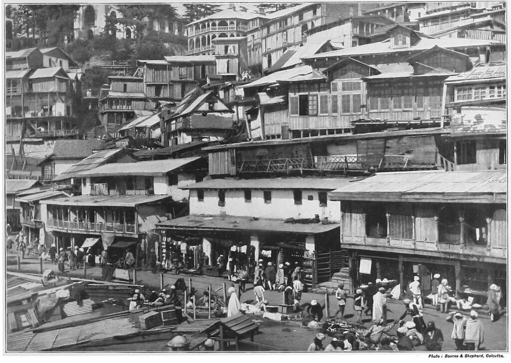
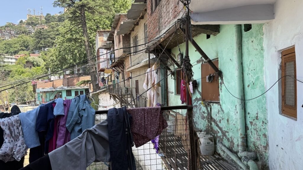
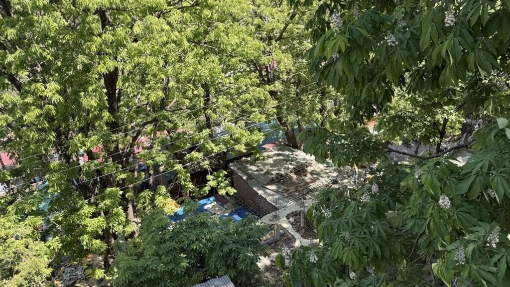
Shimla, the hill-top city, was the British Summer Capital. In the 19th to early 20th century, the upper slopes of the hill were developed for Imperial buildings, residences, and commercial centres. The lowest slopes of the hill settled Muslim and lower caste migrant people who worked for the city. It provided spaces for working class houses, godowns, cattle sheds, coolie quarters among others. Perched on a delicate ecosystem These areas now are at constant risk of environmental hazards such as floods, landslides and forest fires.
Urban SHADE project will work on the biggest informal settlement in Shimla – Krishna Nagar- which grew during colonial times, and the relatively newer informal colony of Eidgah Mohalla in Ruldu Bhatta.
Krishna Nagar
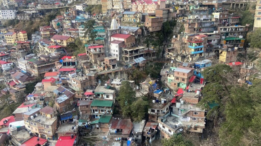
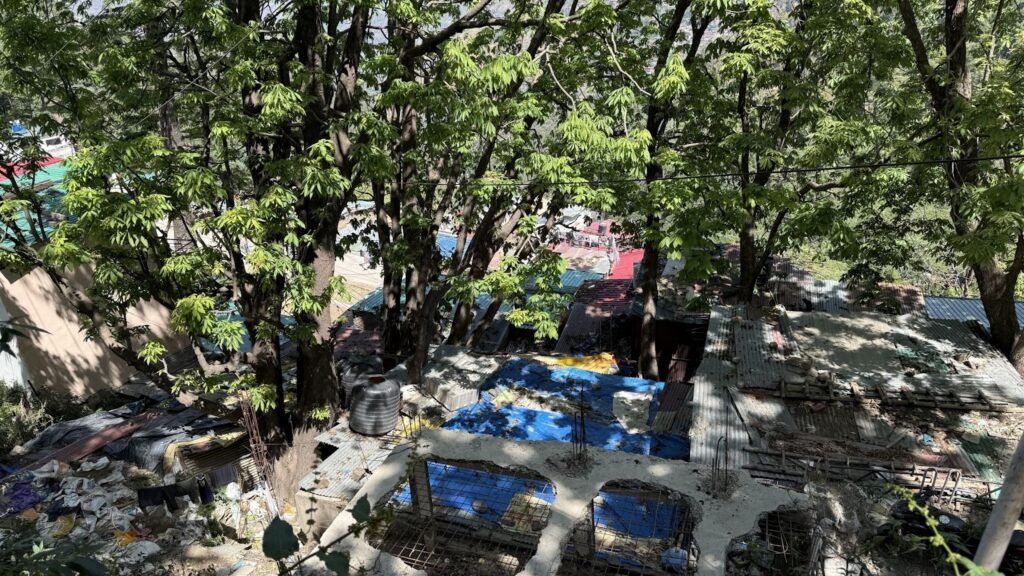
Krishna Nagar is among the oldest settlements in Shimla, and was established during the British colonial rule. While the British elite built grand residences on the upper slopes of Shimla, the working class, mostly Muslim and lowered caste migrant people settled in the lower slopes of the hill or “Below Cart Road.” These persons who served the British empire were tailors, butchers, sweepers, coolies, blacksmiths, shoemakers etc. The area got a new name- Krishna Nagar after India got Independence in 1947.
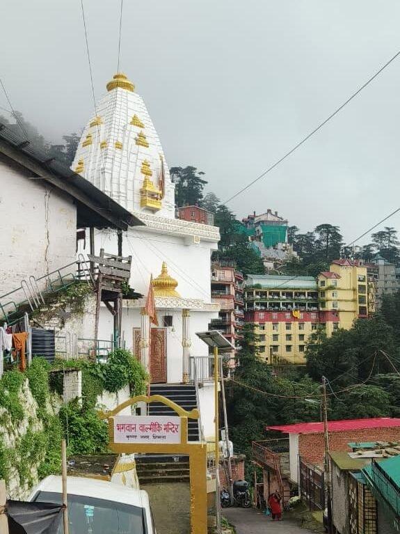
The locality came up on construction debris, near the sewers and slaughter houses. The area got a new name- Krishna Nagar after India got Independence in 1947. Perched delicately on the steep lower slopes of Shimla, it is now at constant risk of hazards such as floods, landslides and forest fires. Many people here are from the lowered caste category. The residents here work in construction, casual labour, sanitation workers under municipal contract, tailor, shop assistant, small food vendor or kiosk operators. This colony has a famous Valmiki temple visited by hundreds during Valmiki Jayanti.
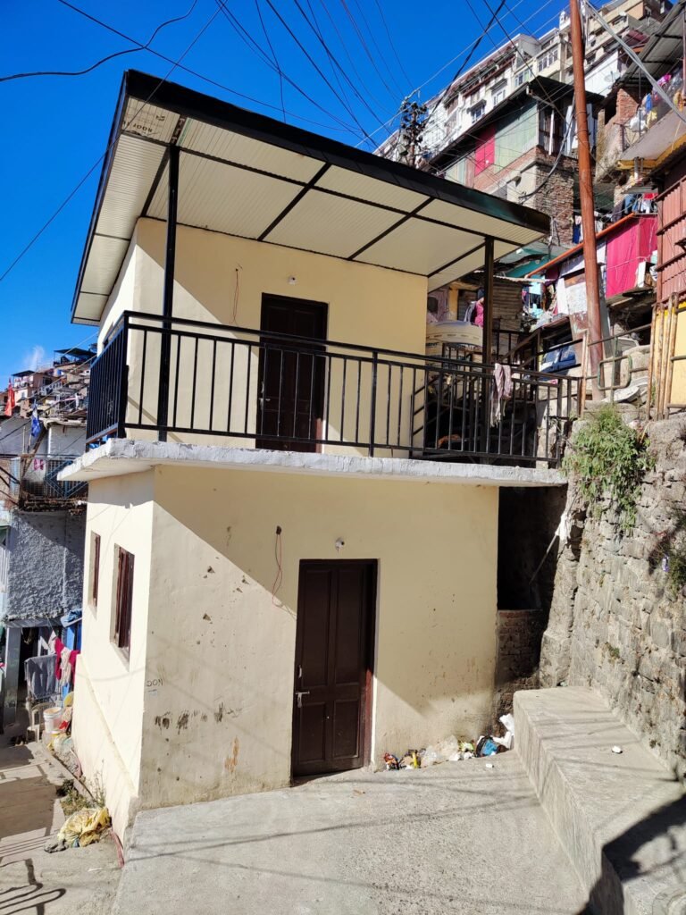
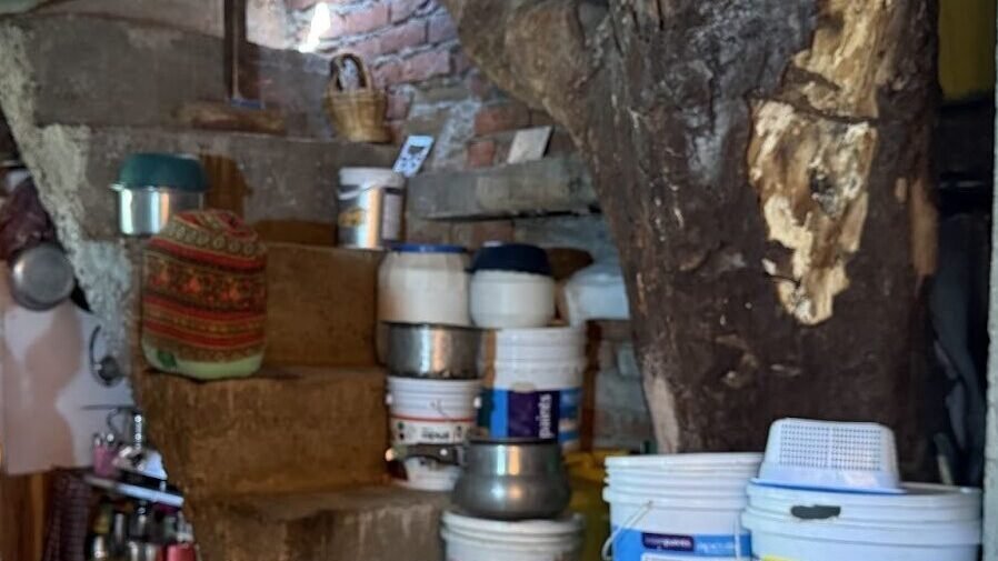
Many families have been living for generations, but most of this area is still informal as most of the residents do not have formal papers for their houses, which are built on deemed forest land. The residents face constant threat of eviction and court orders directing demolition of unauthorised structures. Most of the houses are on encroached lands, and some families have rented houses.
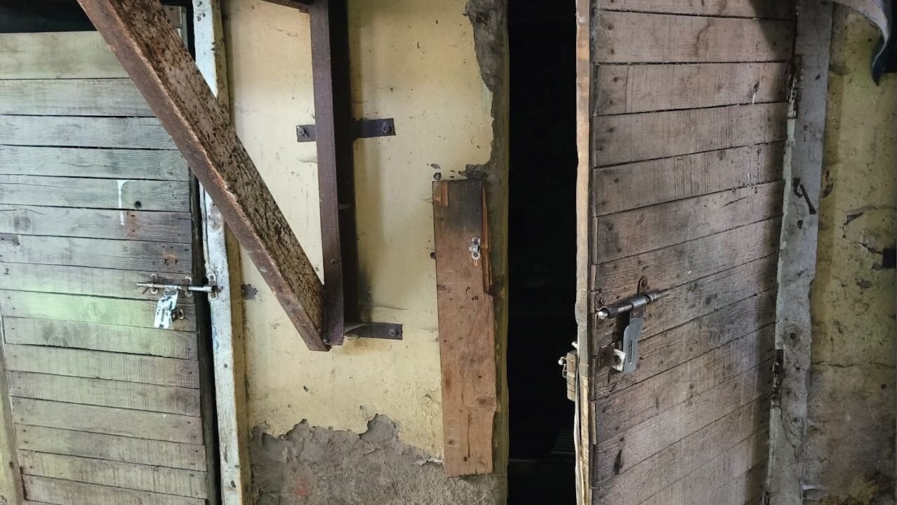
Despite the long history of this settlement, Krishna Nagar faces has not been planned and has poor services. It is a landslide prone area worsened by unregulated construction on fragile slopes and aged infrastructure. While many people have invested in building concrete houses, some houses are makeshift. Despite this, many houses have structural cracks, inadequate roofing and unsafe foundations. Some have even been declared unfit for habitation.
Krishna Nagar had a government Primary Health Centre (PHC). In 2013, the PHC collapsed during the landslide after extreme rains. The ward is now left with a small privately run dispensary known as Gurudwara Singh Sabha dispensary. A building for a new PHC has been made, but the health facility is not operational yet. People with any health issue, big or small, usually end up going to Deen Dayal Upadhyaya Zonal Hospital (secondary level) or Indira Gandhi Medical College (tertiary level). Since they have to go to higher hospitals for smaller health issues, it results in overcrowding and long waits in the hospitals. These invariably result in loss of wages.
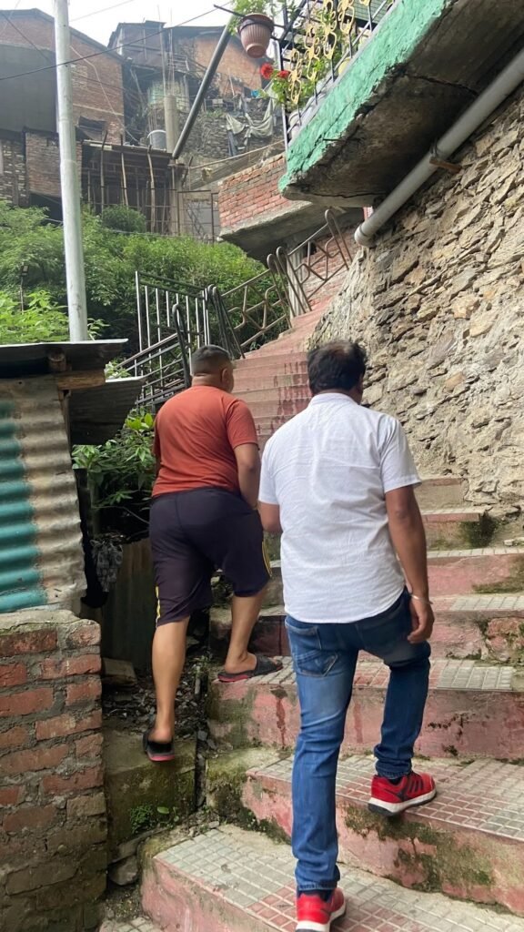
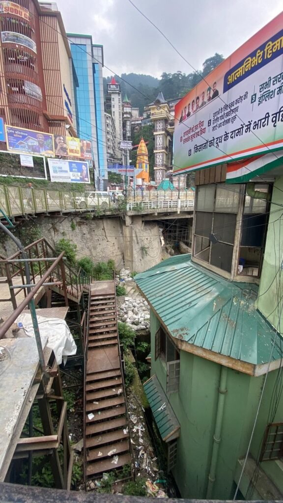
During health emergencies, when ambulances are called for, people have to climb steep slopes and stairs to reach the main road where ambulances can be parked. The pathways inside the colony are too narrow and steep, and can at most allow two wheelers in some parts. These narrow lanes, and insufficient turning radius make it impossible for fire tenders to Krishna Nagar’s areas.
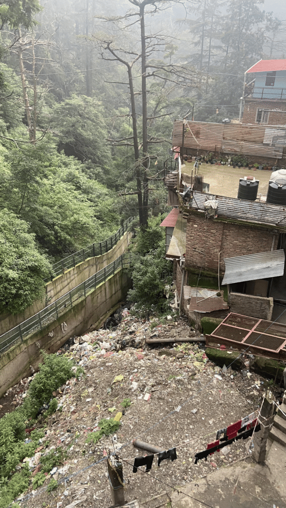
There are no functional drainage or sanitation systems. Drains are open and get chocked during rains leading to contamination, and increasing the risk of waterborne and vector borne diseases. Many houses are built next to the old British-era nalah or drain. During the rains the drain water often flows into the house.
Residents complain that municipal workers do not clean their area, resulting in blocked drains. Houses are built next to these open drains. While many people have invested in building concrete houses, some houses are makeshift. Many houses have structural cracks, inadequate roofing and unsafe foundation, and have been declared unfit for habitation. Many houses here remain damp during the rains. People here complain of suffering from musculoskeletal pain, respiratory issues, and skin diseases.
Residents do not have piped water in many parts of the settlements. In some parts, people share toilets. While there is direct water supply in this area from the Municipality, the flow of water supply is intermittent.
The ward is prone to various hazards such as earthquake, landslide, land sinking, hailstorm, fire, public health risks/ diseases, road accidents, tree falling etc. In 2023, there was a major flood in Krishna Nagar, which felled a landmark Slaughter House in the area, along with several houses. This flood killed at least two persons from the locality. Some houses were destroyed and many people had to evacuate their homes permanently as they were precarious.
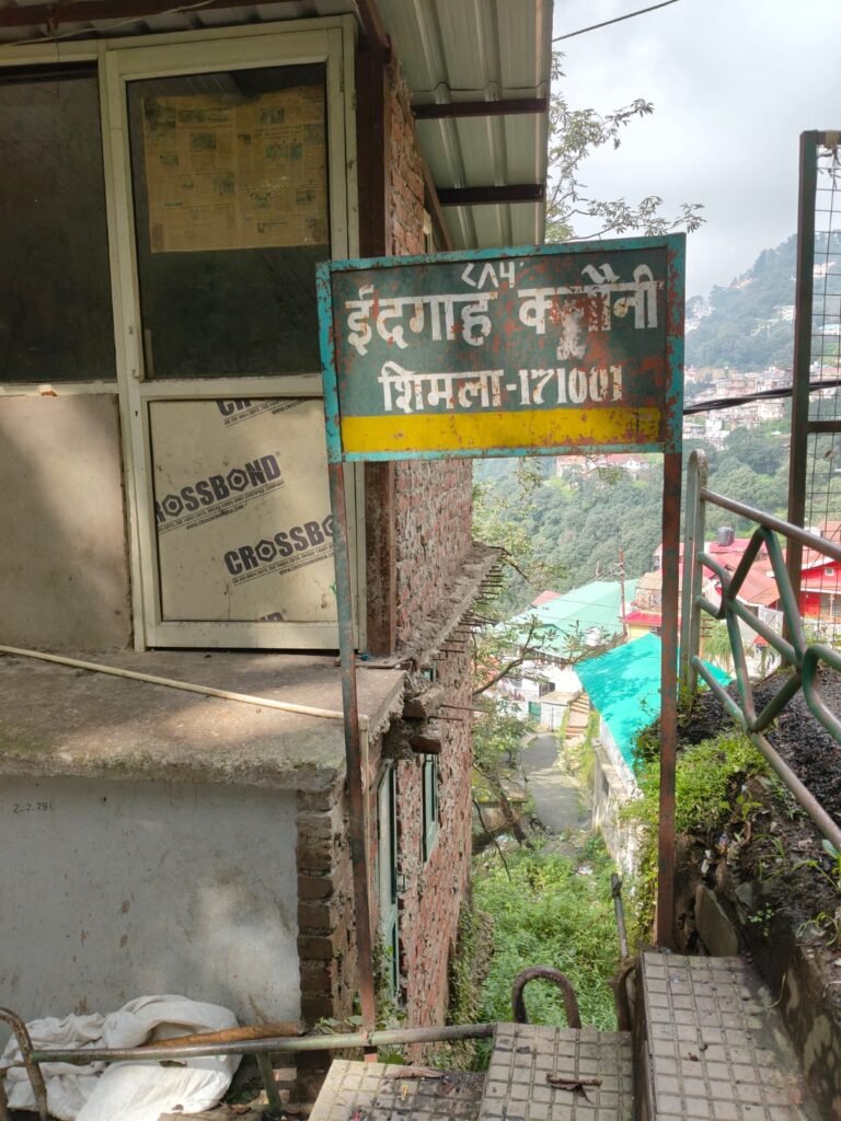
Eidgah Colony, Ruldu Bhatta
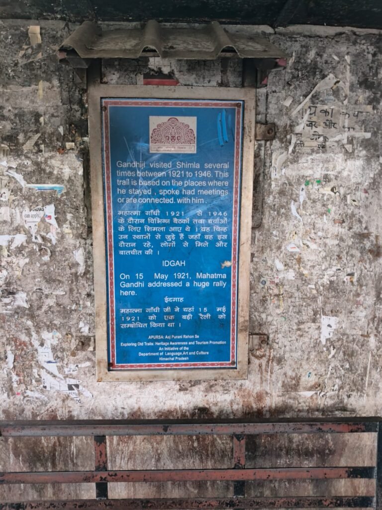
Ruldu Bhatta is the second largest “slum” in Shimla city, second to Krishnanagar. It is home to more than 6000 residents, and is close to popular tourist destinations such as Scandal Point. Eidgah colony is the biggest informal settlement in Ruldu Bhatta.
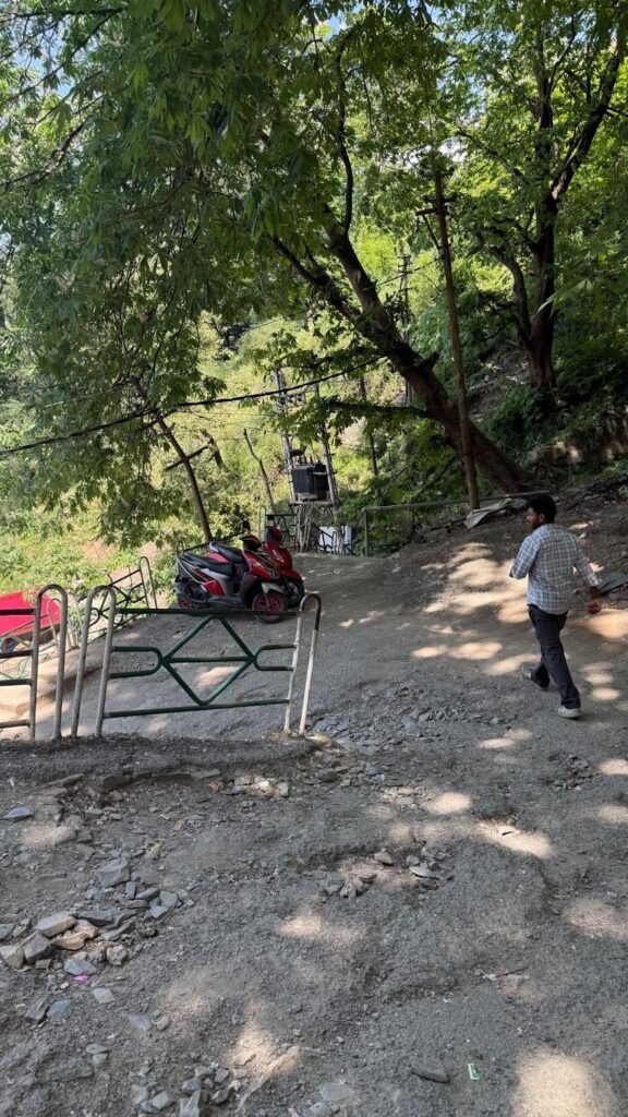
The ward is elevated and has steep hairpin bends, making it difficult for vehicles to ply. Some roads are broken and damaged making it difficult to even walk. Nearly 90 percent of people here live in interior lanes with poor accessibility to motorable roads. Emergency services and fire tenders find it difficult to enter Ruldu Bhatta.
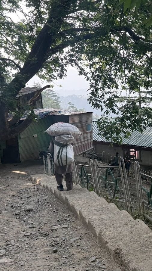
The colony has mostly migrant workers from other North Indian states such as Uttar Pradesh and Bihar. These workers are mostly informal or daily wage labourers, carpenters, welders, construction labourers,often seen walking in a line towards the main road in the mornings.
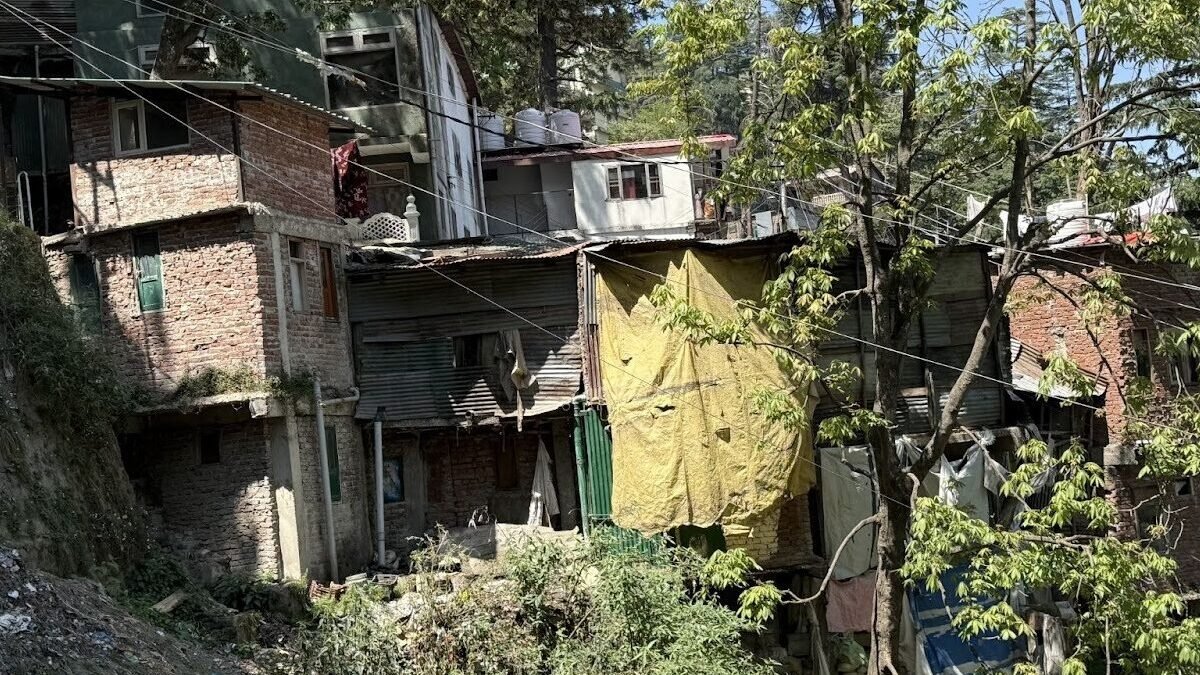
A significant number of houses in the area are built on unstable slopes. The construction of houses inside Eidgah colony is haphazard, precarious and appears to be constructed on top of one another. The walls are a mix of brick, tin sheets and plywood sheets. The roofs are a mix of tin and wood. Roofs of only some houses have linter (structural materials used to provide support to walls and roofs). Many houses have damp walls and cracks, some of which have trees growing inside. This makes the houses precarious during heavy floods, and residents fear trees falling on their houses.
Parts of this ward are prone to landslides and forest fire hazards. During the summer, the ward is prone to water scarcity leading to a drought-like situation. The ward records excess rainfall leading to urban floods and water logging in the months of July, August and September. Parts of Ruldu Bhatta are prone to land sinking.
There is currently no primary healthcare facility in the Ruldu Bhatta ward. The nearest health facility is the Indira Gandhi Medical College (IGMC) or Rippon Hospital also called Deen Dayal Upadhyay Hospital (secondary care hospital).